Thursday, September 23rd we will be having our Hiking for Hunger celebration in Asheville, NC! @highlandbrewing is generously allowing us to set up outside in their Meadow, and we could not be more excited- thank you so much, Highland!
Please feel free to stop by anytime between 4 pm and 7 pm. This is a super laid back, come-and-go-as-you-please type of event to help reduce overcrowding. Our main goal is to provide an opportunity for our supporters and friends to ask us questions and celebrate what we all accomplished together.
What: Hiking for Hunger Celebration When: Thursday, September 23rd 4PM to 7PM Where: Highland Brewing 12 Old Charlotte Hwy #200, Asheville, NC 28803
The shaving of the BAM! Beard will take place at 6 pm. If you are unable to physically be at the gathering, we will be streaming this historic event on Instagram Live. A video will also be posted after the fact on social media and the Hiking for Hunger website. BYOS! (Bring Your Own Scissors) -only kidding, we will bring all of the shaving materials, lol.
If you ordered a Hiking for Hunger t-shirt and opted to pick up at the celebration, we will have those ready for you! Thanks again to everyone who ordered shirts, and another huge thank you to @mhnuckols for hand printing these beauties!
We can’t wait to see y’all! Thanks again for being a part of this journey! ❤
Never in our wildest dreams could we have imagined that the Hiking for Hunger project would take off in the way that it did. $29,707.30 … we are so humbled by the compassion and generosity that has led to this number. A number that will make it possible for @manna_foodbank to help provide up to 118,829 meals to people in need in Western North Carolina. Think about that for a second, what that might mean to someone who doesn’t know where their next meal is coming from. For so many people in WNC being served by MANNA, the funds raised through this project will mean more access to healthy, nutritious meals. What that is is life changing.
This journey has been so deeply enriched for us by all of you- your support of this cause and encouragement along the way has buoyed us and left our hearts so full of determination, inspiration, love. From the bottom of our hearts, thank you. Thank you for being a part of this- we are all Hiking for Hunger.
There’s still time to donate and have it count towards the Bye Bye BAM! Beard Challenge. We now need just under $300 to reach our goal of $30,000. If we can get there before August 25th, Hero will shave BAM!’s beard off at our celebration party in Asheville, NC in September (date/time/location TBD). $5 of every H4H commemorative tee shirt will be donated to MANNA, so get in your orders before August 25th (longer reminder post about tee shirts coming your way in the next few days).
With your help, we have raised over $24,400 for MANNA FoodBank so far! That is over 97,600 meals for our neighbors in WNC.
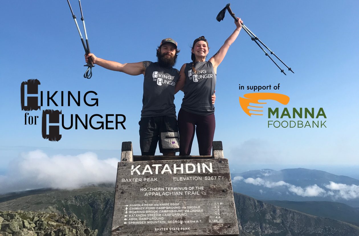
We are currently in Monson, ME and have less than 115 miles left to Katahdin. If all goes well we plan to summit on Friday July 23rd.
MATCHING GIFT! For the final week (July 16-23) donations will be matched up to a total of $1,000 by an anonymous donor. Please spread the word – tell your friends and family! We are hoping to raise over $26,000 before we finish the Appalachian Trail. During this week your donations will go twice as far towards that goal.
Post Summit Plans After we finish the trail we will continue to raise money for MANNA as we work on getting our Journal Posts out for you all to read and see.
BYE BYE BAM! BEARD CHALLENGE! BAM! has challenged you all to see if we can raise a total of $30,000 for MANNA by his Birthday – August 24th. If we reach $30,000 HERO WILL SHAVE HIS BEARD! And we will do it live at a celebration with our MANNA community in Asheville in late September. We will also stream the video live on social media for folks who cannot attend the celebration in person!.
BAM! will be stoked if we reach $30,000 dollars raised by his birthday… he’s not as excited about shaving off his beard. He has been grooming and growing his beard for the past 6 years. Now at the end of the trail it is the longest it has ever been. But, he would be stoked to shave it if it means more people in our Western North Carolina community have the food they need.
T-SHIRTS We will also continue to take T-shirt orders until August 25th and $5 of every shirt payment will be donated to MANNA and count towards our ultimate goal of $30,000. See details about how to order t-shirts in our previous post.
BLOG UPDATE: We are sorry that we have not posted a blog since the Delaware Water Gap. We have been keeping notes, taking photos, and writing. However, we have run out of space on our website and can’t post another full blog with pictures unless we purchase more data. We aren’t sure if we want to continue forward and put more money into this platform or look into other options. Either way, we are going to wait to make this decision until after we finish the trail.
We will get the rest of our Journal entries and pictures out to you all. However, they will have to wait until after we summit Katahdin. If you would like to see pictures and videos of our last 115 miles on trail please follow us on Instagram @hikingforhunger or Facebook by searching Hiking for Hunger. If you do not have Instagram or Facebook we are sorry but, we don’t have another way of sharing our journey at this time. We are working on a YouTube channel but still not proficient in posting videos yet. You can find us on YouTube by searching Hiking for Hunger and we will keep working on it and post future videos through this platform.
Days 86-96: Mason Dixon Line-Blue Mtn Lakes Rd., NJ
Before we dive into this next installment of the blog, a quick note from Hero and BAM!:
Hello wonderful readers! You may have noticed that we have fallen behind on the blog as of late. We wanted to take a moment to let y’all know what’s going on with that and reassure you that we will still be writing entries for the blog- they’ll just be published much later than they have been in the past.
One of the great things about the days lengthening as summer draws nearer is that we’re able to hike for longer hours during the day and cover more mileage. The downside to this is that we have less “tent time” in the evening, which is when we typically write up our notes for the day and do our journaling. We’ve also been hard at work trying to build up our social media presence, especially on Instagram. BAM! is also hard at work launching our YouTube page- stay tuned for deets! Feel free to look up Hiking for Hunger on YouTube and follow us there as we work to get some more timely videos up on our channel. Both of these things, the longer days of hiking and an extra focus on our online presence, have contributed to getting behind on the blog. We have also been taking time to enjoy the community out here on the trail, swapping stories with other hikers and building relationships this has also cut into our writing time but is something we both have been craving especially after this past year we have all experienced.
Again, while we fully intend to continue to publish these journal entries chronicling our adventure, they will be delayed. We really appreciate y’all’s patience with us on this, and we truly can’t thank y’all enough for following along with us on this journey. Now, without further ado, we present to you “The Pennsylvania Push.”
PA Here we come!
Day 86 (Monday, May 10th, 2021)
AT Miles: 9.6
Mason Dixon Line > Chimney Rocks
1076.5 Miles Down, 1116.6 To Go
We woke up in our not so super hotel room and, remarkably, we both had slept really well. We finished our leftover Indian food for breakfast, packed up, and hit the road. We drove nearly the whole way back to Dulles then found a place to get a car wash. The car was covered in dirt and pollen, so we were worried they might take it out of our deposit if we returned it looking so dirty. After the car was squeaky clean, we got some smoothies and continued on to the car rental place. We pulled in to the parking lot to return the car. Someone came up to the driver’s side window and asked for our information. Then they said, “you’re all set just leave the keys on the dash.” We didn’t realize the process would be so quick. We hurried up and grabbed all of our stuff out of the car, trying to make sure we didn’t forget anything.
As soon as we grabbed our packs, we saw Hero’s dad (Tim) pull in – perfect timing! We threw our packs in the back and we were off. He drove us back to Waynesboro, PA where we decided to have lunch before getting back on the trail. We found a cool little spot resembling an old timey diner called Waynesbuger, and they happened to have Vegan Burgers! We were pretty excited and ordered those with some fries and a soda. We had a wonderful lunch with Tim and were so grateful that he drove us back to the trailhead and we’re just glad we had more time together.
Notice the Teddy Bear behind BAM!
After lunch, we drove back over to Pen-Mar Park and Tim hiked back to the Mason-Dixon line with us. We snapped a few photos together and marveled at the soggy teddy bear next to the sign – its fur looked like melting chocolate, but did not seem anywhere near as appetizing. We all stalled there and talked for a while more, not really wanting to leave each other again. Eventually, we said our “so long for nows” and started hiking down the trail. It was so hard to leave family and friends and come back to the trail after this extended break. We really miss our community of people. That being said, we were also glad to be back on trail and picking up where we left off. We have so much more beautiful trail ahead of us.
A really nice shelter area that we passed up to go to Chimney Rocks
We didn’t actually start hiking until 1:30 PM, but that was ok with us- we were only planning to do about 10 miles anyways. We took our time and tried to take in being back on trail – it was beautiful! We pushed past some very well maintained shelters, some of the best we’ve seen, because we heard there were stealth campsites near Chimney Rocks, and we really wanted to catch the sunrise for our first morning back on trail. Right before we got to Chimney Rocks, I spotted a small patch of Pink Lady’s Slipper, the first ones we’d seen this year.
We pushed up to the side trail leading to the view and there are plenty of beautiful tent spots. Hero scouted out the nicest one and we put our packs down. We decided to run up the rocks and see what this view is like before getting set up – it was nice! We came back down and Hero built the tent while I made our signature first meal of the ration: vegan mac ‘n cheese. Another couple of hikers came in while we were cooking. They were so quiet we didn’t notice them at first, but then we waved and said “hi” and exchanged greetings- they seemed really nice, and the guy, we found out, helps maintain this section of trail. We were pretty tired after our long day traveling, so we crashed right after dinner.
View from Chimney Rocks
-BAM!
Sunrise at Chimney Rocks
Day 87 (Tuesday, May 11th, 2021)
AT Miles: 28.1
Chimney Rocks > Pine Grove Furnace State Park
1104.6 Miles Down, 1088.5 To Go
It’s 5:30 am. We have to readjust to waking up early, but today we are motivated by the promise of a beautiful sunrise at Chimney Rocks where we camped out for the night. We get ourselves out of the tent and up the rocks and indeed it is breathtaking! We have our pop tart breakfast up there with us and take it all in. Phase Two and Shebeast (the couple that camped near us last night) have also woken up for sunrise, so we chat with them for a bit as the sun pops up above the horizon line. It turns out that they are both avid section hikers and Phase Two is one of the trail maintainers for this section, so we talk about the trail and BAM! and I thank Phase Two for all he does to look after this section.
Soon after the sun has fully emerged over the horizon, we all head back to our respective camps to finish packing up. Both BAM! and I need to dig some cat holes, so it takes us a bit longer to get out of camp. Phase Two and Shebeast wave goodbye and say good luck to us as they head out and turn left to go southbound on the trail. We do a final sweep of camp, throw our packs on our backs, and take the right turn back out on the trail to head north.
It really is such a beautiful morning as we get going. We’re both still feeling fresh from our recent time off and excited to be back on the trail. It’s a good thing- we’ve got a lofty mileage goal for the day ahead of us. We’re going to try and make it to Pine Grove Furnace State Park if we can. We know it’ll be a push- 28.1 Miles if we can swing it- but we want to take advantage of some of the relatively flat and gradual Pennsylvania terrain while we have it.
We are walking along when we encounter a day hiker coming from the other direction. We all stop and chat for a bit and he lets on that he’s done some moderate section hiking over the years. His tone starts to shift and we notice that he’s beginning to give us some unsolicited advice regarding the Hundred Mile Wilderness up in Maine. He goes on like this, and at one point when he’s taking it upon himself to determine how fast we can make it through the Hundred Mile Wilderness, he looks me up and down. He points his trekking pole at me and says “If she’s up for it, you might be able to do it in four days. Maybe.” If she’s up for it. Not if we’re up for it- if she’s up for it. Me. He is, without a doubt, calling into question my ability based on the fact that I am a woman. He knows nothing else about me other than I look and sound like the mainstream notion of what constitutes a woman. I shake my head and give him a look while BAM! immediately jumps in and starts talking about how I am actually the faster and stronger hiker of the two of us- the guy cuts him off and continues to repeat his refrain. I know it’s kinda useless, but I’m grateful to BAM! for trying to bring some kind of awareness into the picture. Unfortunately, this guy doesn’t seem open to what BAM! is saying- he keeps interrupting him. I’m starting to move away from the guy, my body no longer facing towards him but facing northward on the trail- I’m ready to be out of this space, and I can tell BAM! is, too. I signal to him that it’s just plain time to go, and we start walking away. We get a good bit away before we start talking about what happened. We’re both upset but try to figure out how to respond when someone else further up the trail inevitably says something akin to what that guy said to me. But we’ve talked about this before, because it’s happened before, more times than I can count on both of my hands now. We brainstorm while also holding space for the fact that confrontation is not something that either of us are inclined towards. I’d like to say we figured out a solution, but you can’t know exactly how you’re going to react in the moment when these situations arise. Every time I think I will call out the sexism the next time it happens, I just would prefer to walk away and keep hiking. Time will tell, but for now I’m choosing to be kind to myself and not berate myself for just wanting to get away from the situation. I shift my focus to our goal of getting to Pine Grove Furnace State Park, where we hoped to partake in the Half Gallon Challenge.
We make good time getting to Caledonia State Park, where we fill up on water before moving on. While we are there, we call ahead to Pine Grove Furnace SP General Store to check in about ice cream. We had called them about a week prior during our time off to see if they’d be able to get some non-dairy ice cream in. It seemed at the time like it wouldn’t be a problem. Today, we called and heard a different story. Apparently, the guy we talked to last week had just gotten back from vacation and the freezer was empty- no ice cream whatsoever. When we called, he was in the middle of figuring out if he’d be getting ice cream in at all today. We expressed sympathy for the situation he was in and told him, too, that we were going to try and get to Pine Grove Furnace by 6/6:30 pm before he closed at 7 pm- if he happened to have vegan ice cream, we’d be excited to buy it. Regardless, we were excited to visit the store. He said okay and the call ended. We kept pushing on, still intent on making it all the way to Pine Grove Furnace despite the ice cream uncertainty.
Another beautiful shelter where we are not staying
We push the miles, the really nice terrain of Southern Pennsylvania working in our favor. We meet a pair of SOBOs (Bugs and Bambi) and a section hiker (Showtime) at the nicest shelter I’ve ever laid eyes on. Not only was it nice and clean, but it featured skylights, a bench swing, an immaculate spring, a sundial, and even more homey touches- so fancy! As we get close to PGF, we reach the AT Halfway Mark and soon thereafter pass 1100 Miles! We pass by another section hiker named Rambler and push on past the shelter where we initially thought we’d be staying before the call of ice cream had its hold on us.
Not a stick
Nom nom nom – such a yummy blaze!
HALFWAY!!!
We are dead on our feet by the time we see the first sign for PGF, but we’re still in good spirits- it’s only 5:45 pm, so we made it there faster than planned! We round the corner and know that the stone building just up ahead of us must be the Pine Grove General Store. My heart sinks and my jet-speed pace starts to falter- they are not open. We’re stunned- we had just talked to the guy who works here earlier that day. How are they not open? I approach the door and a small sign on the door indicates that current hours Mon-Fri are 11 am-5 pm. Crestfallen doesn’t even begin to cover it- we are beyond bummed. We unstrap our packs and throw them down next to a table while we decide what to do. Mercifully, there is a soda machine on the patio, so at least we can have a little something sugary and bad for us after our long day. I plop down in a chair and sip while I simmer and attempt to reel in my disappointment. I let go of my hopes of doing the Half Gallon Challenge here at PGF and focus my attention on the more pressing matter of where to stay the night. We’re trying to save some money, so we pass on the hostel in the creepy yet fascinating old mansion next door (we also missed the cutoff time for check-in, so that helps with the decision making process). The campground is not free, and it’s a fair walk down the road- ugh. We’d rather keep moving on and find camping further up the trail, but we would have to walk quite a ways to get off of the State Park property- no camping allowed anywhere but at the official campground. After some discussion, we decide on the PGF campground and start making our way down the road. The road walk hurts our already sore and achey feet, and as it takes longer than we initially thought it would, we start to wonder if we’ve made the right choice. But we get there, select a tent pad with a picnic table, and get to work on our camp chores.
While eating dinner, we face the next challenge head on: where are we going tomorrow? We look at both the AT guide and Guthooks and realize that there is a stretch of trail coming up where there is no camping allowed for about 18 miles, with the exception of a site around the town of Boiling Springs. Because of where we are tonight, we’d have to push waaaaaaay past a 30 mile day to make it to the other side of that 18 mile stretch- we know already that we are not going to feel up for that, and yet we need to make some bigger miles to keep on track with getting to the Delaware Water Gap in time for our second COVID shot. The only other option to get us the kind of mileage we’re hoping for is to stop in Carlisle. We look at the lodging options there and, having just stayed at the sketchiest Super 8 ever, we’re a bit tentative. We don’t want another experience like that, but we also can’t spend a lot on a room. We remember that one of our friends is from Carlisle- maybe she can tell us where we could stay that would be good but also reasonably priced. BAM! shoots her a text. Minutes later, a response: her parents would be happy to host us for the night. It’s unexpected and completely serendipitous, and we are immediately filled with gratitude and a huge sense of relief! Our friend sends BAM! her mom’s contact info and we start making plans.
Light starts to fade from the sky. I go to the bathroom (flush toilets and sinks, y’all!) a hundred yards from our campsite one last time before bed. I climb in the tent once I get back and start to bundle up- it’s already getting chilly. BAM! joins me after finishing up with getting tomorrow plans ironed out with our friend’s mom. We snuggle up and drift off to sleep, which comes easily now that the stress that once surrounded tomorrow has lifted.
-Hero
Appalachian Trail Museum- it was closed
Day 88 (Wednesday, May 12th, 2021)
AT Miles: 27.3
Pine Grove Furnace State Park > US 11 (Carlisle, PA)
1131.9 Miles Down, 1061.2 To Go
We left the State Park early, making one last stop at the bathrooms on our way out. We were still feeling a little bummed that we didn’t get to try the Half Gallon Challenge at the iconic spot, but we’re still planning to do it later. We were also a bit sad that we didn’t get a chance to check out the AT Museum- maybe next time.
The Pine Grove Furnace and Azaleas!
We decided to make a stop at Green Mountain General Mercantile for an early lunch. We were craving snack foods, especially since we weren’t able to purchase anything from the Pine Grove Furnace store. We ordered some curly fries from the grill and got some chips and Stewart’s Orange Cream Soda. We went out to a picnic table and enjoyed our lunch in the sun. We tried not to linger since we had our friend’s parents picking us up in Carlisle tonight and we didn’t want to get in too late.
Nice little lunch stop!
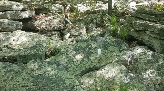
We pushed through what we dubbed the “mini coaster” since it was a series of short climbs and descents. On the top of some of those climbs, there were large rocks that we had to navigate through like a maze. The white blazes literally took us around, up, and through the large boulders on a seemingly pointless route. In our guide, this section is labeled “The Rock Maze,” and there were two of them in this section. I guess the trail maintainers thought we needed an extra challenge! We met a nice couple at the Old Center Point of the trail. We chatted with them a while and listened to some of their stories from the trail. They were really nice and they told us their trail names: Cigar Lady and Old Tools. We said farewell to them and continued down to the pastures.
The next 15 miles consisted of flat fields and towns in what is known as the Cumberland Valley. We got to the first section of pastures and were super conscious about ticks – we checked nearly everytime we got to a clearing or a road crossing. Several of our friends who passed through this area before us said they found ticks after hiking through these fields. We went through the picturesque town of Boiling Springs, PA. We saw the children’s lake with all the ducks waddling about. We found the ATC Regional Headquarters there, and at the back of the building there was a spigot where we filled our water. It would have been a nice spot to hang out and have a snack or something, but we had to keep pushing because we had a warm bed and wonderful people waiting for us in Carlisle.
We went through lots more fields and crossed over many more roads and did several more tick checks. We finally arrived at the road where we planned to meet Ev and David. We walked over to the Quality Inn and arrived a couple minutes early- David wasn’t there yet. We took off our packs and sat down on a median in the parking lot- our feet were done at this point. Minutes later, David pulled up and greeted us then helped us get our packs in the back of the truck and we hopped in. We were so grateful that they offered to let us stay in their home tonight.
We chatted with David on the ride back, and he is so friendly and makes us feel right at home. When we get to their house, I opened the car door and David says, “you’re about to be attacked”. As soon as I angel myself out the door, an energetic golden retriever is in my lap wiggling excitedly and trying to lick my face. He is so adorable – I love every moment of it. It lasts only a moment because then Hero opens her door and he rushes over to see her. His name is Crosby and he is a two year old bundle of energy and a lover.
Crosby checking out the hiker smells
Ev comes out to greet us and so does her granddaughter. We grab our packs out of the back and Ev shows us to our room. The house is beautiful! She lets us know that dinner will be ready soon but to take our time and get settled in. We both start with much needed showers and get our stuff organized then head downstairs. We can smell dinner as we come down and it smells delicious. Ev has made sweet potato and black bean tacos with a guacamole sauce. We sit down and Ev offers us a glass of wine. Hero and I look at each other and say, “sure! why not”. David pours us a glass and we take a sip, it’s nice. Everyone sits down and we dig in. The tacos are delicious – Hero and I both have at least three each. It was so sweet that they made a completely vegan meal for us. We talked throughout dinner and really enjoyed the conversation and the company. After dinner, Hero and I went upstairs to work on a few Hiking for Hunger things. When we came back down, Ev and David were watching Mrs. Doubtfire in the living room – one of my favorite movies! We sat down and joined them. Ev offered us sodas and we both had a ginger ale. She also tried to find us ice cream or sherbert that we could eat in their freezer, but no luck. We told her we didn’t need anything else, we were already blown away by their generosity and the way they made us feel so welcome. After a little more Mrs. Doubtfire, our eyes were at half mast and we knew we needed to head to bed. We said thanks again and goodnight, then headed up to our room.
-BAM!
A wonderful breakfast with our Amazing hosts!
Day 89 (Thursday, May 13th, 2021)
AT Miles: 22.9
US 11 (Carlisle, PA) > Clark’s Ferry Shelter
1153.8 Miles Down, 1039.3 To Go
The faintest of light is just starting to creep into the world. It’s just visible between the yellow drapes that sway ever so slightly in the wind that gently whispers through the open windows. This is our cue to start waking up and get packed up, as much as we’d love to sleep in and enjoy being snuggly in this cozy bed. We do so and then venture downstairs for breakfast. Ev is down there- she’s laid out a whole assortment of breakfast options! It’s not often that we get to have cereal these days, so we take advantage of the opportunity to have that with some almond milk. There are bagels, too, and homemade jam- so heavenly! We enjoy this delicious treat and chat with Ev as we fill our bellies. David joins at one point, too, and Crosby the dog hovers nearby. It’s a great start to the day, and I think both BAM! and I could easily just stay here if that were possible, but we know we’ve got to get back on the trail and keep moving. We do get out a little later than we were planning because we are so enjoying hanging out with Ev and David- we’re so grateful for them and can’t get over how gracious they have been!
Eventually, it’s time to say goodbye to Ev and Crosby. We thank Ev profusely and climb in the truck with David, waving energetically as we pull out of the driveway and back onto the road. We talk with David during the ride back to the trail- like us, he’s done some hiking in Colorado, so that was a point of connection. In no time, we’re back at US 11- David throws on his four ways and pulls to the side of the road so we can safely get our packs out of the bed of the truck. We thank him again and he wishes us good luck on the rest of our journey. Then we turn and face the trail once more.
We spend the next stretch hiking the rest of the field section that doesn’t allow camping, worrying incessantly about ticks and checking ourselves frequently when we go through super tall grass. Despite the tick worry, it’s a pretty section and we are in great spirits as we plug along. We cross a lot of roads, which apparently is the name of the game here in Pennsylvania. We run into a group of Amish women enjoying a backpacking trip- we exchange big smiles and hellos as we pass each other. After some time, we arrive at Hawk Rock, a spot with a view overlooking the town of Duncannon below. We snap a few pictures but move on pretty quickly- we are eager to get into town for food and a quick resupply.
Anyone else see Nessy in this pic?!
The descent into Duncannon is rocky and steep in sections, but we’re able to navigate it safely and get down alright. Soon, we’re walking on pavement and entering the town proper. Our first stop once we’re in town is Kind of Outdoorsy, the local outfitter which also now boasts a hiker hostel. We’ll stop in here to see what we can get for our small resupply, and anything we can’t find we’ll look for at the Quick Mart around the block. We’re able to find some Knorr Rice Sides and packets of oatmeal- that’ll cover breakfasts and dinners. We don’t really find any good options for vegan friendly snacks, so we resolve to check out the Quick Mart for those. We take our items to the counter and it turns out the lady who works there has been following us on Instagram! Wow! How cool is that?!?! She’s super nice and praises us for what we’re doing and we thank her so much for following along. We’re giddy as we sign their logbook and make our way out of the store.
We exit the store, but I sit on one of the benches outside with our packs while BAM! runs over to the Quick Mart to finish up our resupply. I start searching for food options for us- we’re in town, so we figure we might as well grab an early dinner, which will save us some time later on when we get to camp by not having to cook. There aren’t a whole lot of options for us, but I find out that we can go to the pizza joint across the way and we should be able to get pasta marinara without any cheese or meat- it’ll do! BAM! returns from the Quick Mart with snacks for the trail as well as some yummy things to eat while we’re still in town. As we are getting our food packed up so we can head over to the pizza place, a familiar voice calls our names. We turn to look back towards the front entrance to Kind of Outdoorsy and there’s Lost Bells! It’s great to see her again and catch up on all that she’s experienced since the last time we saw her. After a few minutes of swapping trail stories, we say farewell to her and move on.
Hiking down into Duncannon
Blaze painted on an underpass
We walk across the street to the pizza place. BAM! isn’t convinced that the pasta alone will be enough, so we order a cheese-less pizza, too. We scarf it all down and savor our last bit of town time before moving on from Duncannon. While walking the town portion of the trail, we discover that the residents are super friendly! Several people smile, wave, and wish us luck on our journey, including a guy who tells us to look out for his house as we walk down the street: “It’s the one with the 8 ft bear in the yard!” Sure enough, we spot it a little ways further, haha! Soon we are crossing over the mighty Susquehanna River. We get to look back at the mountains we came down earlier today and it is both a beautiful and deeply satisfying moment despite our being on a noisy bridge with lots of cars and trucks flying by. After getting across the bridge and crossing a few railroad tracks, we are back in the woods, climbing up Peters Mountain. It’s a steepish climb, but we’re still feeling spry, probably because we took such a nice long break in Duncannon. As we are doing the last few miles to shelter, we start to experience more rockiness- is this the start of how Rocksylvania got its name? Time will tell.
Snake Skin!
We make it to the shelter and discover that the only other person there is camping, so we spring for the empty shelter. Because we ate an early dinner in Duncannon, we spend the rest of the evening snacking, stretching, and writing. As light fades from the sky and the sounds of evening start to press in, we cozy on up in our double bag and drift off to sleep.
-Hero
Morning View of the Susquehanna
Day 90 (Friday, May 14th, 2021)
AT Miles: 25.3
Clark’s Ferry Shelter > Tent Site Near Rausch Creek
1179.1 Miles Down, 1014 To Go
We struggle to get ourselves out of bed this morning, hitting snooze several times and wishing we could just go back to sleep in our cozy cocoon. We had stayed up later than we intended, working on our writing and other H4H stuff, and then neither of us really slept all that well. Finally, we manage to pull ourselves together and get out of the sleeping bag. While we are eating breakfast and getting organized, the section hiker who tented a few hundred yards from the shelter last night joins us at the picnic table. He introduces himself as Peaceful Turtle, and we all share pleasant conversation over breakfast. We finish up our food, pack up, say farewell and good luck to Peaceful Turtle, and link back up with the trail.
The day starts with a ridge walk. There are little ups and downs, but for the most part this section is pretty level. Every so often we encounter rockier sections that make us wonder if we’re starting to really truly enter the domain of Rocksylvania, as we’d been told it was the northern section of trail in PA that is notorious for its rockiness. But so far it doesn’t seem too crazy. As we hike the ridge, we enjoy beautiful views of the Susquehanna River, and the weather is really quite mild. Despite the good conditions and pretty views every so often, we’re in a bit of a funk this morning, probably because we didn’t sleep all that well. We keep on, though, as we try our hardest to push miles and make our goal for the day.
Both of us start to realize after an hour or so on the trail that we’re going to need to brown blaze into Peter’s Mountain Shelter in a few miles. We get there and meet a thru hiker named Turtle Hawk. I seem to be more desperate for the bathroom than BAM! at this very moment, so I rush over to the privy. When I get back, Turtle Hawk and BAM! are talking about a game, something that sounds a lot to me like Dungeons and Dragons. It turns out that Turtle Hawk is working on creating a game akin to Dungeons and Dragons, but specifically for thru hikers. He asks us if we’d like to join and be characters in this game and we say yes, absolutely. BAM! is filling out his preferred “powers” and then I do, too. Other thru hikers have also filled in their “powers” in Turtle Hawk’s game. As we get ready to move on from the shelter, Turtle Hawk says that he’ll send us an update on the game and we say thank you and wish him luck on the rest of his thru hike. We really enjoy this stuff, the things that other hikers come up with to engage each other and create spontaneous and fun moments on the trail. Admittedly, this section of the trail can feel a lot like a grind, and we as well as other hikers are trying to find ways to keep our spirits high so we can keep going.
Do you see the Skink?
Pringles with a view!
We continue hiking and eventually get to a spring a couple hundred yards off the trail near Clark’s Creek and stop there to fill up on water. We are both feeling tired, and BAM! is having trouble continuing on because of how exhausted he is. He asks me if we can take 20 minutes to power nap before continuing on. I worry about getting into camp late if we take too much more time, but I can also tell BAM! is really tired. Him advocating for a nap over pushing through is an indicator of just how tired he is- he’s usually one to just push through. I nod yes, let’s do it, and he sets an alarm, finds a flat spot, puts his butt pad down, and lays his head and shoulders on it, the rest of his body in the dirt. He slides his hat over his eyes, folds his hands over his stomach, and within 30 seconds I hear him snoring. Wow, he is seriously tired! I decide to lay down for the 20 minutes, too, and although I don’t quite enter a deep sleep like BAM!, I can feel a haziness and restfulness take over. In what feels like no time at all, the alarm is going off, and I’m jolted from that weird half-asleep, half-awake state that I had slipped into. I turn my head to the left and see BAM! stir and start to come to- he tells me that he had dreams during that short 20 minute power nap! He feels a bit better now, and we still have 11 miles to go, so we collect ourselves, make sure our water is all topped off, and get going.
Pretty soon after we’re back on trail, we throw in our earbuds and start listening to music- it helps us push the rest of our way to our goal camping spot for the night. Originally, we were thinking about staying at the Rausch Gap Shelter, but when we see that it’s a little ways off trail, we opt to get a bit further and camp at some tent sites just off the trail near the creek. The spot turns out to be perfect- it’s nice and open near the tenting area, but still has some tree coverage for privacy from the trail. There are remnants of the old stone buildings that were a part of a coal mining community that was located here but had to be abandoned when the operation wasn’t producing enough to be competitive.
After dinner, we crawl into the tent and look ahead to the next day- there’s a beaver dam just a few hundred yards further down the trail that we’ll be crossing first thing in the morning. What fun that will be! For now, we are so tired and just want to crash out and hopefully make up for some of the lost sleep from last night.
-Hero
Morning Fern Forest
Day 91 (Saturday, May 15th, 2021)
AT Miles: 27.5
Tent Site Near Rausch Creek > Tent Site Near Black Swatara Spring
1206.6 Miles Down, 986.6 To Go
After eating breakfast and packing up, we start the day by crossing the beaver dam a couple hundred yards from our campsite. Knowing that we’d be getting our feet wet for this one, we take off our hiking shoes and put on our camp shoes. We start to walk slowly and carefully across the dam, trying to stay on top of it as much as possible. There are a few spots where we have step into knee high water- it’s super mucky and quite cold! But not terrible, and honestly it’s just so neat to be crossing this incredible feat of beaver engineering. BAM! takes the opportunity to film a BAM! of the Day. I keep moving, slowly lifting my feet with each step so that I don’t lose my camp shoes in the muck. Eventually, I get to the other side of the dam and find a stump to sit on so I can wipe off my feet and put my hiking shoes back on. BAM! joins me shortly thereafter, and after our feet are cleaned off and back in our shoes, we start hiking again.
Beaver Print!
Wading through the beaver pond
We’re both feeling sluggish this morning, and we try not to overwhelm ourselves by thinking about the 27.5 miles ahead of us. Instead, we enjoy the early morning hours in which the temperature is perfect and the sun isn’t bearing down on us ruthlessly. BAM! cracks me up at one point when he practically yells a cheerful “hello” to a couple of hunters who are trying to be stealthy. Not long after passing the hunters, we come to a road where a gentleman is offering some trail magic. He gives us each a vitamin water and some Larabars. We talk to him for a bit and find out the his name is BooRay. Really nice guy, and we so appreciate the trail magic he provides as well as information about the trail ahead!
We continue to meet nice people along the trail as we work our way through Swatara State Park. When folks hear that we’ve walked all the way from Georgia and are heading up to Maine, they express excitement and wish us good luck- it feels good and reaffirming every time we hear such positive feedback! We keep plugging along, passing under I-81 and working our way up some switchbacks up onto a ridge. The ridge walk feels endless. For as much as the flat terrain is kinder to our bodies, longer stretches can feel interminable. At some point while up on the ridge, we come to the William Penn Shelter and each take advantage of a much needed privy stop. From there, we press on, and when we finally come to the next road crossing we find TurtleHawk (the thru hiker we met the other day) and his friend set up with some trail magic. They have coolers full of treats and chairs set up so that thru hikers can sit down and relax while they take a break. It’s fun to see TurtleHawk out here, and we think it’s super awesome that he’s using his zero day to pay it forward and show other thru hikers some love. While we’re there, we meet another thru hiker named Teacher. He leaves the trail magic spot around the same time we do, so the three of us hike together for a couple of miles. Eventually, he branches off to check out a shelter a ways off the trail that supposedly has a shower. We continue on, but tell him that we’ll likely see him further up trail.
If nature gives you blow downs- make a bridge!
BAM! and his Best Ferns!
We found the rocks!
After a while, we reach the tree that marks the 1200th mile of our journey- woohoo! We snap a few quick photos and keep walking- we’ve still got a ways to go to make it to our campsite for the night. Not long after, a hiker ahead of us starts to come into view- he’s hiking fast, but we’re gaining on him. I catch glimpses of him from around BAM!, who is walking in front- there’s something familiar about the hiker just ahead of us. We catch up to him and it turns out to be Goldie! This is the first time we are seeing him since we crossed paths at the Nantahala Outdoor Center back in North Carolina! It’s awesome to see him again- we weren’t initially sure if our paths were going to cross again before reaching Maine, but here we all are! We all hike together to the next water source near the Hertline campsite. It’s fun chatting with Goldie, and it really helps pass the time. Before we know it, we’ve arrived at Hertline and we all get to work on water. Not long after we start filtering, Teacher shows up. He’s planning on staying here at Hertline for the night, but BAM! and I and Goldie are all trying to get a little further so that we’re set up to get into Port Clinton on the earlier side tomorrow. Goldie finishes filtering first and heads out- he might be heading to the campsite we’re looking at, but he might try to push further. At some point, the person staying in the tent that was already set up when we got here emerges- she goes by S8parks and we talk with her for the rest of the time that we are filtering. Once we’re all topped off, we say goodbye to Sparks and Teacher and press on.
1200 Miles!!!
It’s another 5 miles to our goal campsite and boy is it a trudge. We both throw on music to help us make it these last miles as our bodies start to tell us that they’re running low on gas. It’s a push, but we make it- we are not going any further, though. Goldie isn’t here- he must have decided to push on- but we meet a flip flop thru hiker named Arizona who is set up for the night in his hammock. He’s getting ready for bed when we show up, so it’s a quick “Hi, how are ya” before he’s crashing out. We try to be as quick and as quiet as possible while we get set up and make dinner. Soon enough, we’re heading to bed with the hopes of catching as many Z’s as possible before our early start in the morning- my mom is resupply us in Port Clinton and I can’t wait to see her!
-Hero
The train yard at Port Clinton
Day 92 (Sunday, May 16th, 2021)
AT Miles: 26.4
Tent Site Near Black Swatara Spring > Tent Site Near Panther Creek Spring
1233 Miles Down, 960.1 To Go
I woke up several times before the alarm went off, worrying for some reason I wouldn’t hear it or it wouldn’t go off. I would wake up, check the time on my phone, and then try to go back to sleep. The other thing waking me up was my aching feet. No matter what way I slept and what angle my feet were laying, they hurt. When 5am finally came, I was already awake and knew I wasn’t getting back to sleep. I still hit snooze for 5 minutes, and Hero and I cuddled a bit longer. Then the alarm went off again and I sat up and started getting packed.
I got out of the tent and took the first few steps of the day. It hurts to walk and I am limping around like I’m literally walking on eggshells. The more I walk, though, the more my feet seem to loosen up and hurt a little bit less. We were trying to be very quiet while packing up because Arizona was still sleeping. By the time we finished packing and ate breakfast he was awake. We said goodbye to Arizona and got on the trail.
Within the first few miles, we saw Goldie at the next campsite up trail. He had pushed a few more miles last night. We said good morning and had a quick chat, then said we hoped to see him again soon. We needed to make miles this morning because we were meeting Momma Grant in Port Clinton. As we were hiking, we met a group of four guys hiking and struck up a conversation. They asked some questions about our Thru-hike and the Fundraiser. One of the guys, trail name PIMA which stands for something I can’t say on the blog (Pain In My… you get the picture!), had section hiked nearly the whole trail. He gave us some advice and encouraged us to take our time and eat some berries in Maine. They were a nice crew. We said goodbye and pressed on.
We were running a little late at this point and the descent into Port Clinton was very steep with nothing even resembling a switchback. We tried to keep up the pace but our knees were screaming at us and my feet were starting to ache again. They seem to get a little better in the mornings as we start hiking, but as the day progresses the pain gets worse again. We walk down to the train tracks as Momma Grant pulls up. She parks and we run over to greet her. It was so good to see her and we were very grateful that she brought us a food resupply.
She tells us there is a Burger King down the street so she can just drive us there to get Impossible Whoppers for lunch. That sounds great to us so we throw our packs in the back and hop in. Cushioned seats feel so nice we could easily take a nap in the back seat. We went to a gas station first to use the bathroom and find sour patch kids, then to BK and we got Impossible Whoppers. We each got two whoppers and a side of fries. After scarfing those down, we swung by Walmart to grab a few things.
Momma Grant drove us back to the trail station and parked in the exact same parking spot that we had left from to make sure we didn’t miss any of the trail – HaHa! We packed up the resupply she brought us and said thanks, then came the challenging goodbye. We all hugged and cried a bit. We knew we would see her again soon, though which made it a bit easier. Goldie came by right before she left, and Momma Grant offered some stuff we weren’t taking. We also told him that it looked like someone was set up with trail magic right down the trail a bit.
We started hiking a couple minutes later. We walked past the van offering trail magic and saw Goldie and Arizona there enjoying some food. The trail angels offered us some and we said thanks but we’re full. We had just downed a lot of BK and what they were offering definitely wasn’t vegan friendly. We said thanks and told them we appreciate what they’re doing for hikers, then pushed through Port Clinton.
The rest of the day was a slog. We did another 13.2 miles after picking up the resupply. The day seemed to drag on and my feet were very sore. It felt like my arches were on fire and I had pain with every foot strike. I knew my shoes were near the end of their life, but this seemed like something more. Still, I thought that maybe my feet are just really bruised and beat up from all the pointy rocks. Either way, I was slowing down and we didn’t get into camp until much later than we had hoped. We still made it before sunset, but barely.
Bunny!
Hero started setting up the tent and I went to get water. As painful as my feet had been hiking, it was so much worse just standing still as I waited for our water bucket to fill up. Now my arches were screaming with pain and I had to lift one foot at a time and walk in place to try and relieve some of the pain. I sat down to cook and this helped relieve the sharpest pains and reduced it to a steady ache. I tried to get up as little as possible for the rest of the evening. After dinner, I took some Tylenol and hoped it would dull the pain enough for me to sleep a little better tonight.
– BAM!
Pennsylvania Farmlands
Day 93 (Monday, May 17th, 2021)
AT Miles: 26
Tent Site Near Panther Creek Spring > Tent Site North of George Outerbridge Shelter
1259.1 Miles Down, 934 To Go
It’s about 3:30 or 4:00 in the morning when noises outside of the tent wake me. For a few seconds that feel more like excruciatingly long minutes, I lay there just listening, still only half awake. My heart rate starts to tick up as my deliriousness lessens and I begin to register the sounds. My hand instinctively gravitates towards BAM!’s. I squeeze his hand and he squeezes back- the noise beyond our nylon walls have woken him up, too. We both lay still as the sounds of several somethings walking around draws closer to our tent. At some point, I can hear, very clearly, something sniffing just outside of my side of the tent. Hearing this stirs something in me, and I immediately yell “Hey!” very loudly. The sniffing stops and we hear the somethings that were surrounding the tent retreat- their movements fade away as they run further from our tent. When it has been quiet for a few moments, I let out a sigh of relief: “That got me, I was scared for a minute there,” I say to BAM!, turning to face him. He returns the sentiment, and we both begin to speculate as to what the somethings could have been. “Hunting dogs, possibly,” he says, “We’re on State Game Lands, and it sounded like those animals were wandering around a lot like domestic animals. Wild animals are more efficient with their movements- they don’t wander all about like that because they need to conserve energy.” It makes sense, but we’re still not 100% sure what exactly it was outside of the tent. That is until BAM! gets up to go pee about a half an hour later. He has his red light on and it catches a pair of glinting eyes no more than 20 feet away. It catches him by surprise, so he turns on his bright light so he can see exactly what it is he is having a staring contest with- it’s a doe, who apparently could care less about our presence as she continues to snack in our campsite. So, perhaps it was actually a herd of deer outside of our tent earlier? It seems unlikely now that it would have been hunting dogs, what with the doe that has stubbornly remained at our campsite. BAM! comes back to the tent and we try to get a little more rest before we have to wake up.
We wind up sleeping later than we should given the miles we are trying to do today, but our bodies need the rest badly. We’re still tired after being woken up by what we now think were a bunch of curious deer earlier this morning. It takes some effort, but we get ourselves to start packing up around 6 or 6:30. We eat breakfast, filter water, finishing packing up our packs, and roll out.
Not long after we get going, it hits me: I’ve gotta GOOOO! I hope that I can make it to Eckville Shelter a couple of miles away where there is supposed to be a flush toilet. I’ve gotta make it there, I tell myself. It gets to the point where I have to run ahead of BAM! I get to the road and am confused- is it down the road? I yell back to BAM! and he replies that “yes, you’ve gotta go down the road.” I start going that way (waddling that way, really), and after a while a house appears with a sign in front indicating that this is where the Eckville Shelter is located- interesting. BAM! and I look around in search of the bathroom- there are few different structures onsite that could be it. I find it and jump inside- I’m so glad I made it. BAM! has to go, too, so we trade places once I am done. There’s a spigot, so I fill up our water bottles while I wait. There’s a place to charge electronics, so we take advantage of that, too, though we don’t stay much longer. We see the caretaker, but only briefly. A man looking for the trailhead has parked his car in the caretakers driveway, so the caretaker is asking him to move his vehicle.
We leave Eckville, a little sad that we didn’t stay there last night (free access to a flush toilet, shower, and electrical outlets are a big deal to thru hikers, y’all), and start pushing miles. We’re pushing, the rocks are wreaking havoc on us, and we are hurting. This section of trail is literally taking us up over massive rock piles for no apparent good reason- the trail could have easily been routed around the piles of sharp, shoe destroying rocks. Around the point that we reach Allentown Gap Shelter, we’ve started discussing alternatives for how to proceed. These big mile days in the thick of Rocksylvania are really taking a toll, and we are running out of steam. We’re worried that if we keep doing what we’re doing that we might wind up getting injured. At the same time, we’re feeling like we need to get the miles done so that we can give ourselves time to recover from our second dose of Pfizer, which we plan on getting in a few days once we reach my moms house near Delaware Water Gap. As we brainstorm, we think of a way that we could do this that won’t run us completely into the ground. Once we have our game plan figured out, we call up my mom and see if she can help us pull off this adjusted plan (it includes picking us up a day early and helping us slackpack a few days). She’s totally down, and we are so relieved! We just need to get through the rest of today and tomorrow- she’ll pick us up in Wind Gap tomorrow afternoon. I get off of the phone, and though we still have a lot of ground to cover today, BAM! and I rejoice. We finish up with our snack break and press on.
We hit a lot of rocks. Rocks on rocks on rocks. To my surprise (and his), BAM! has to go dig a cathole in the middle of all of this- he encourages me to press on to the next marked water source and get a jumpstart on filtering. I do this, traversing over some of the super rocky spots along this section. Some spots are cool, like the Knife’s Edge, which makes me feel like I am climbing along the spine of a massive dinosaur. But for the most part, it’s a lot of that same Rocksylvania sharp, pointy rock stuff that’s been killing our feet. I’m excited when I hit a patch of less rocky trail and can walk with relative ease. I’m getting close to the road and parking lot area near Bake Oven Knob. Before I get to the road, I stumble upon a water cache! Woohoo! I don’t have to worry about filtering water- that’s a huge win in my book! Thank you trail angels! With this wonderful new development, I am able to take off my pack and chill for a second while I wait for BAM! to catch up. I chug some water and fill up my bottles and BAM!’s little bottle. About ten minutes go by and I see BAM! rounding the corner. “Take a look at this!” I say to him as he walks up. He sees the gallon jugs of water and is stoked! He takes off his pack and joins me for a short break while he chugs and then tops off his water bottles. We can’t stay too long, though- we’ve still got a ways to go to get to home for the night.
Oh look more rocks!
We leave the wonderful, amazing water cache, crossing the road and parking lot and rejoining the trail as it heads up to Bake Oven Knob. Immediately, we start to see lots of graffiti and realize that this must be another spot like High Knob back at the end of Maryland. It doesn’t take long to get to the top of Bake Oven Knob, but it’s a complete boulder field and, true to its name, we feel like we’re getting baked in an oven the sun is beating down on us so intensely- we just want to be on the other side of this and back under some tree cover, so we keep moving. Our energy is starting to flag, but we’ve still got another 7.5 or so miles to go.
Finally, after what feels like forever, we get to the shelter. It’s completely full, so we need to push past it and look for a stealth camping spot. We’ve got to grab water beforehand, though- otherwise, we’d have to backtrack up a rocky mess of a trail to the spring at the top of the hill. I hang back to try and fill up all of our water vessels while BAM! continues in search of a spot for us to set up camp. Tiredness is really starting to set in now, and I am clumsy as I work on filling the CNOC bag and our Sea to Summit collapsible bucket. Twice, I manage to knock the bucket over and have to start over with filling it up. Finally, I have our vessels filled and can start making my way down this rocky trail. I walk for a while and don’t see BAM! I thought he said the stealth site marked on guthooks should be right around here? I keep going and still don’t see him- I yell his name. He doesn’t answer the first time, but he does the second time when I yell and I’m a little further down the trail. He yells back and I spot him a few hundred feet off trail- he’s found a spot that is tucked back a ways, apparently the first level spot he could find. It turns out to be a great little tenting site- it’s getting dark, so we work on setting up and cooking food. We try to be as efficient as possible so that we can go to bed ASAP- we’ve got an early day ahead of us. We climb into the tent, both of us feeling so sore and achey and tired. I don’t even try to write notes for the day- I get settled in and just try to get some sleep while the sounds of the nearby highway sing their nighttime lullaby.
-Hero
View of the Lehigh River
Day 94 (Tuesday, May 18th, 2021)
AT Miles: 21.5
Tent Site North of George Outerbridge Shelter > PA 33 (Wind Gap, PA)
1280.6 Miles Down, 912.5 To Go
We hardly get any sleep because of getting into camp so late last night, but we still have to wake up early to crush out the miles ahead of us by 4 pm. We are both resistant to the sounds of our alarm, and yet the promise of meeting my mom at Wind Gap later today motivates us to get moving.
It is just starting to get light out when our packs are on our backs and our feet hit the trail. We reach the road, whose sounds we listened to last night, fairly quickly. Right ahead of us as we cross the bridge, we can see the mountain we must be going up first thing this morning: Blue Mountain Ridge. We stare at it as we get closer and closer, cross the street when we get there, and start to climb. In no time, we’re walking across (you guessed it) rocks. And yet, the rocks along this section of the trail aren’t too bad, not so pointy. As we really start to climb, it becomes a bit of a scramble to the top, but this early in the morning while we’re still somewhat fresh it’s actually kind of fun and invigorating. It also helps that it’s nice and cool and the sun isn’t high enough in the sky yet to be quite so brutal. The payoff view when we get to the top is also pretty nice- BAM! even does a BAM video on top!
We get to the top and I’ve gotta dig a hole, so I go take care of that before we continue hiking. As we start to walk the ridge, we see a lot of new growth, including some aspen trees which we are curious about- you don’t typically see aspens in this area. Then we realize we must be going through the section of trail that used to be a Superfund, where they are now trying to regrow trees and plants. We take it in now with even more curiosity, speculating on the trees and plants chosen for this rehabilitation effort and why.
BleedingHeart
Aspens
We get to the bottom of the Superfund mountain and from there it is a steep and rocky but short push up from Little Gap Rd. We make quick work of it and are up on the flat ridge before we can break too much of a sweat. Shortly after flattening out on the ridge, we run into a thru hiker not already known to us at a trail intersection. He introduces himself to us as Slug-o, and within a few seconds he is offering us his extra water, which winds up saving us a trip down and back up a steep 0.6 trail to a water source. Because of this incredible time-saving magic, we are able to stop for a second and chat with him for a little while. He’s a really nice guy, and after we part ways with him we immediately hope we can return the favor and help him out further up the trail.
A few miles after our encounter with Slug-o, we come across a water cache at Smith Gap Rd. It’s a total life saver and makes us feel confident that we’ll make it to Wind Gap without having to filter more water, a good thing because there is no water on this ridgeline. The other cool thing is that we are now getting back into familiar territory- we have hiked this section before during one of our training hikes! We’re excited and we know that we now only have 8 miles left, so we really start to push! We throw on some tunes to help us focus, syncing up so that we are both listening to Hamilton. We sing along together for the parts that we know and walk as quickly as we safely can to Wind Gap.
A few hours later, we start descending into Wind Gap and we couldn’t be more stoked and ready to be done. After getting down the hill and walking under the bridge, we cross the road and plop down in the dusty, gravel parking lot and breathe a sigh of relief. We wait for a few minutes, thoroughly enjoying the fact that we are no longer walking. My mom shows up- we are so grateful and give her big hugs, which she accepts even though we smell terrible. We’ve arrived earlier than we anticipated by about an hour and a half, and so we have some time to pick up food before my mom has to start her evening class. The three of us order Indian food and pick it up on the way home.
We get home and it’s such a strange and wonderful feeling to be back after 3+ months of hiking our way back north from Georgia. It’s great to see Aunt Jo and be back at our home base for a little bit. We’re hungry, but showers are calling, so we get cleaned up before digging into food. After dinner, my mom has class, so BAM! and I, wiped out after pushing as hard as we have lately, veg out and watch Gilmore Girls for the rest of the night.
-Hero
Back at Kirkridge Shelter!
Day 95 (Wednesday, May 19th, 2021)
AT Miles: 16.8
PA 33 (Wind Gap, PA) > Kittatinny Visitor Center (Slack Pack)
1297.4 Miles Down, 895.7 To Go
We wake up feeling so refreshed after a good nights sleep in our cozy bed. We’ve got some miles to make today, but man do we feel like brand new people! Not doing quite as many miles yesterday and ending before 3 pm (as opposed to hiking until 8 pm) meant that our feet got some extra much needed rest. Plus, we get to slackpack today, and we get to wear our new shoes, and we are hiking less than 20 miles for the first time in at least a week- life is good!
We get up and get going, dressing in fresh clothes (aka not the Thru hiking clothes we wear everyday)- it feels good to change it up! We even get to use one of our daypacks today rather than using one of our backpacks as a makeshift daypack- what a luxury! BAM! goes to the kitchen and cooks up a yummy breakfast. He is the king of breakfast bagel sandwiches, I swear- so so so tasty and such a treat!
Eventually, we are ready to get going. We’re setting up a self shuttle today, so the first order of business is to drop off our car at the Kittatinny Visitors Center, which is where we’ll be ending our hiking today. Mom follows us there in her car, and once we have parked and locked the car we hop in with her and she drives us back to the trailhead parking lot where she picked us up yesterday in Wind Gap. Once there, we jump out of the car and get ready to hike, saying thank you and see you later today to my momma and we start heading up the hill.
We’ve got a short, steepish climb to kick things off, but we’re rocking our new shoes and hiking without full pack weight today, so this hill is not stopping us. Once it’s past us, we’re cruising along the trail, feeling light as a feather- even the rocks can’t get us down!
Wolf Rocks
We plug along, focused on knocking out miles so we can get home and do the Half Gallon Challenge. We’d walked this section before back in late January when we were doing our training hikes- it’s so different now in the springtime! We get to the Kirkridge Shelter and are excited to find gallon bottles of water on site- at least 30, if not more! We decide this is a good spot for a break and enjoy some snacking. Before we leave, we camel up and top off our water bottles- it sure is a great day when you don’t have to filter water!
Writing on the back of the same journal we wrote in back in January
View from Kirkridge
We get up to a section where the trail joins a fire road and we spot a grouse walking along the trail! I’ve never seen one in person, have just heard the crazy pounding sound they make to try and deter predators. It’s nice to finally actually see one! I’m able to take a short video of it before it flies away.
The fire road section ends after a while and we start the descent into Delaware Water Gap. There are some gorgeous views of Mt. Tammany across the way, the Delaware River down below. As we get closer to the bottom, we run into Slug-o! We wind up offering him a ride to the store once we all get done. He takes us up on it and we tell him we’ll shoot him a text once we get to the Kittatinny Visitor Center, which is a bit further that where he is stopping in the town of DWG. He lets us pass by him, but soon he’s passing us again because we have come to a magical pond with lots of tadpoles and frogs. BAM! shoots one of his Beauty Appreciation Moment of the Day videos while I try to count up as many frogs as possible- there are so many! After moving on from the pond (which is hard for us), we’re come to the familiar little town of Delaware Water Gap, and then we come to the infamous I-80 bridge crossing. We crossed over this monstrosity during one of our training hikes- it’s our least favorite bridge crossing on the AT because there is so much traffic and just a sad concrete barrier separating it from us. Time to get it over with, and cross into New Jersey! The PA/NJ sign is painted into the sidewalk in the middle most part of the bridge. We take a few pictures, the intense afternoon sun casting some intense shadows, and keep walking so we can get off of this crazy bridge. We are so excited to be off of this bridge and we are so thrilled to have Pennsylvania in the rearview!
Hello New Jersey!
We get back to the Kittatinny Vistor Center and pick up the car. BAM! texts Slug-o, and after getting the thumbs up that he’s ready to go to the store, we go pick him up. It’s fun talking with Slug-o during the car ride to the store. He’s a really nice guy, and he asks us lots of questions about Hiking for Hunger. We drop him off at the Wal-Mart when we get there, and we drive across the street to the Giant- we’re planning on doing the Half Gallon Challenge when we get home tonight and we know Giant has a good selection of vegan ice cream. We’re able to get stuff quickly, and Slug-o is efficient, too, so we pick him up from Wal-Mart and take him back to the Deer Head Inn. He expresses his gratitude and we thank him again for saving us by giving us his extra water the other day. Then we all part ways, telling each other that we hope to run into each other further up the trail.
We get back home and start preparing for the Half Gallon Challenge. We haven’t eaten anything recently and are plenty hungry going into this. We get everything set up and then begin… and it is AWFUL. I don’t know that I have ever felt more physically uncomfortable in my life. By the second (of four pints) I was ready for it to be over. My tongue and lips were numb and my stomach could not understand what I was doing to it. I’d look across the table at BAM! every so often and could tell that he was just as miserable, but he was definitely getting that ice cream down faster than I was. It got to a point where my competitiveness kicked the curb and I couldn’t care less if BAM! won- I just wanted this to be over with. BAM! does win, but he’s in rough shape. I finish about 3 or 4 minutes after him- I feel terrible. Neither of us feels great for the rest of the night
The Half Gallon Challenge
-Hero
Oh DAM!
Day 96 (Thursday, May 20th, 2021)
AT Miles: 16.6
Blue Mtn. Lakes Rd. > Kittatinny Visitor Center (Southbound Slack Pack)
1314 Miles Down, 879.1 To Go
We’re both still not feeling super great when we wake up this morning- doing the Half Gallon Challenge was clearly a mistake. But we’ve still got a day of hiking ahead of us, so we pull ourselves together and start getting ready. As we are making breakfast in my moms kitchen, I’m thinking about how many miles we have ahead of us- 27+ miles planned for the day. I know with this “sugar hangover” that I’m not feeling like doing that many miles, and I can’t imagine BAM! is either. I propose to him that we cut our day short and he’s on board. Rather than doing 27, we’ll do 16.6- much more reasonable. We update mom on the new plan, and after we’ve all eaten and have gotten organized, we hop in the cars and get going.
We once again drop off our car at the Kittatinny Visitor Center (the exact same parking spot, too! Ha!) and then jump into moms car. But today we head north instead of south- we’ll be slack packing SOBO back to our car. We drive along steep, windy roads that my mom says are probably closed during the winter, at least that’s what she has heard. When we get to our drop location, we are up on a ridge in one of the northernmost sections of the Delaware Water Gap National Recreation Area. We bid my mom farewell and get moving.
Overall, this section is pretty gradual with just a few little ups and downs (“boops” as we like to call them). We’re both still feeling pretty blah and are mostly focused on just getting the day done. Most of what we are hiking today, save a few miles at the beginning, are sections of trail that we hiked during our training a few months ago. It’s cool to see how it has changed now that it is spring, but we’re still feeling ready to have these miles knocked out so that we can go home and veg out. We do really love seeing the view from Kittatinny again, and Sunfish Pond is absolutely gorgeous, but we rejoice when we start descending into the gap and find our car waiting for us at the visitor center.
We hop in the car and drive home so that we can shower and get organized before we head out again to see our trail friend, Goldie. He’s just gotten into DWG and is in need of a trip to the store for a resupply. We offer him a ride to the store and ask him if he’d like to grab dinner- to our excitement, he says yes to both! We pick him up at the hotel where he’s staying and drive to the Giant. After we have all grabbed the things we need, we go back to the hotel so Goldie can drop off his food. Now to decide on what we’ll eat. It turns out that Goldie is a big fan of Thai food, too, so we all get jazzed about finding some good Thai. Sure enough, there’s a place not far from the hotel, so we cruise that way.
We get to the Thai restaurant and find a nice table on the patio overlooking a grassy field with a dark green forest beyond it. It got pretty hot out during the day today, but it’s starting to cool down now, making for a pleasant evening temperature. Our waitress is super nice and takes our order after we’ve had some time to think on it. While we wait for the food to come out, BAM! and Goldie and I enjoy some great conversation. Though we’d met briefly at the Nantahala Outdoor Center back in North Carolina, this is the first time we’re getting a chance to spend time with him. It’s really fun getting to know Goldie, and we learn more about what has driven him to pursue an AT thru hike.
After a delicious meal, we wrap up with dinner and drive back to Goldie’s hotel. We part ways with him, all of us saying how much we hope to run into each other again further up the trail. Then he shuts the car door and walks into the lobby of the hotel. BAM! backs up out of the parking space and we head back home. We get there and spend the rest of the evening relaxing before we crash out. We don’t stay up too late- we’re getting our second COVID vaccine first thing in the morning, so we want to get a good nights sleep!
-Hero
Feeling Accomplished (for finally finishing this blog post)
Days 74-84 (Resting Up, The Four State Challenge, a Week of Rest, And a Final Goodbye to Virginia)
Days 74-76 (Wednesday, April 28th, 2021 – Friday, April 30th, 2021) AT Miles: 0 Charles Town, WV and Harpers Ferry, WV
Made ourselves some vegan pasta and meatless balls!
Because we arrived at Harpers Ferry, WV early, we had three full days of rest before we’d be doing the Four State Challenge. Usually we wouldn’t take so many zeroes in a row, but because we had set up the Four State Challenge as a fundraising push, we felt we needed to stick to the plan and do it on May 1st. We were planning on doing live updates on our progress throughout the day so that people at home could follow along with our progress. As much as we wanted to hike more and knock out some more miles before our week off scheduled for right after the Four State Challenge, it just made more sense logistically to take advantage of the three 0s. Plus, it gave us plenty of time to rest up and catch up a bit on some of our writing that we’d fallen behind on.
Our Air BnB in Charles Town, WV was located in the apartments right above Abolitionist Ale Works. In fact, the Air BnB is owned by the folks who run Abolitionist Ale Works. Suffice it to say, we were hanging out downstairs in their outdoor space a lot. To make it even more fun, Batman hung out with us for a night or two. Good beer, great company, fun atmosphere, and just a few steps away from what was our home for a few nights- what more could a couple of thru hikers ask for? If you find yourself in Charles, WV, we highly recommend the Air BnB space above Abolitionist Ale Works.
Mmmm!
On Friday, my (Hero) dad and stepmom and brother came into town. They would be helping us with logistical support during the Four State Challenge. They arrived in the afternoon and we all went out to grab some yummy food to eat. It was great spending time with them, but it once again felt really short, this time because BAM! and I need to try and go to sleep early- we’d be waking up at 2 am to get going on the Four State Challenge. That night we stayed at the Quality Inn in Harpers Ferry because it was closer to the trail that the little gem of an Air BnB we had in Charles Town. After saying goodnight to Dad and Janis and Tyler, BAM! and I tried our hardest to get to bed quickly. We failed miserably- we were just too wired with anxiety over what was to come in just a few short hours…
So Grateful for our Family!
-Hero
Day 77 (Saturday, May 1st, 2021) The Four State Challenge AT Miles: 43.3 VA/WV Border > Mason Dixon Line 1047.1 Miles Down, 1146 To Go
We tossed and turned for most of the night, so much so that by the time our alarm went off at 2:00 am, we both felt as though we’d only gotten a few minutes of sleep. We both emit a synchronized groan at the sound- why did we think it would be a good idea to hike over 43 miles today? It seemed extra crazy now that it had finally arrived. As we get packed up, I try to focus on the big picture, how doing this as a fundraising push is going to help so many families struggling with food insecurity in WNC. I resolve to keep them front and center in my mind today, to remember them during the hardest of moments. Around 2:20, there is a knock on the door and my dad’s voice asking if we were close to being ready. I respond that yep, we are just about ready. We scan the room one last time to make sure we aren’t leaving anything behind. Then we walk out, following Dad and Tyler down the hall and stairs and out into the parking lot. We throw our packs into the trunk of the car, climb in, and Dad starts driving the short drive to the trailhead.
The spot where we’re getting on trail has not even the slightest possibility of a place to pull over on this windy mountain road, so dad throws on his four ways and we work quickly to get the pack we are using for the day situated. We are not taking both of our packs with full weight today- that whole hiking 43 miles in less than 24 hours thing, ya know! We want to be as light as possible so that we have the best chance of successfully completing this challenge without hurting ourselves. This is the last time we’ll be seeing Tyler- he’s going into finals week at school and can’t stay to help my dad and Janis for the whole day. I’m just so grateful that he came out to hang with us yesterday and see us off this morning. The fact that he did so even with final exams and papers looming near means the world to me, and as we hug goodbye I’m just awash with a feeling of immense gratitude for this person who is just the epitome of thoughtfulness and genuine kindness. Tyler, if you’re reading this- you’re my hero, brother! We wave goodbye to Dad and Tyler, saying to Dad that we’ll see him soon once we reach the spot where the trail crosses over the I-70 bridge about 24 or so miles north of here. Then we turn to face the hill.
Just got dropped off
We’ve got to climb back up this thing. We’d already crossed the VA/WV border when we dropped into Harpers Ferry a few days ago. I remember as we came down this hill that first time that we both miserably noted that we’d have to climb back up it for the Four State Challenge. You see, in order to do this challenge properly, we’ve got to start in Virginia, so we’ve got to backtrack a bit and redo some mileage we’ve already done. The spot where Dad and Tyler dropped us off is the closest we can get, but it’s still a 0.6 mile climb back up the hill. We sigh and start the ascent.
As we walk through the woods, which is cloaked in darkness with the exception of whatever our headlamps illuminate, the wind is whipping something fierce and trees are swaying and creaking ominously. Yesterday, the wind was even more intense, apparently so much so that several trees were brought down. We encounter a few as we near the VA/WV border, stepping over one and going around another that would have been harder to step over. We converse, in part to keep each other company but also to try and make any critters out and about aware of our presence- neither of us much felt like accidentally sneaking up on a bear at this hour. Finally, we make it to the border. We snap a few photos and BAM! does a quick video that we get up on Instagram and Facebook to let folks know that we have officially begun the Four State Challenge at 3:08 am. We nod to each other knowingly and start our journey.
We descend back down the hill and past the spot where Dad and Tyler dropped us off. We enter the woods on the other side of the road and keep going. After a few minutes, BAM! stops abruptly just ahead of me. I whisper “what’s wrong?” and as I do, he turns up the brightness on his headlamp and a deer is now clearly visible ahead. BAM! sighs in relief and tells me that with his headlamp on a lower setting, the deer ahead of us had just appeared as a pair of glowing eyes without a hint at the form around them. I let out a deep breath, too, letting the spike in secondhand adrenaline subside a little. We move slowly past the deer so as not to scare it too badly, then keep pushing forward. In what feels like no time, we are back on the bridge that crosses over the Shenandoah River. It’s so different being here in the dark without trucks and cars constantly whizzing by. There are a few early risers that zoom by us, but not many. We finish crossing the bridge and enter the woods that line the periphery of Harpers Ferry. This time, we don’t take the side trail to the ATC Headquarters. We keep moving and are soon nearing the part of the trail that actually goes through town. At one point, we pass by a tree and scare up a large bird, an owl I assume, but in the darkness it’s just a shadow of abrupt movement- my heart leaps and I let out a little gasp.
We are quiet as we walk through the town. There’s a lot of history at Harpers Ferry, and you can’t deny the energy of the place, especially in the dark early morning hours. It’s dead quiet, and the unnerving sensation that permeates the air makes me feel like I should be holding my breath as we pass through. I want to get across the bridge and into Maryland quickly, so I hurry BAM! along as he stops to take pictures and record a video, citing the fact that our friend Ben is meeting us ahead as the main reason to keep moving. In actuality, I just can’t overcome the weird feeling that I’m getting as we walk through what is considered one of the most haunted towns in America. Don’t get me wrong, I love Harpers Ferry. It is, after all, the birthplace of my AT thru hiking dream. But I feel a lot more at ease in Harpers Ferry during the daylight hours.
An alley in Harper’s Ferry as we hike by
Harpers Ferry in the Daylight
A big wooly Caterpillar
Crossing the River next to the train bridge
We cross the bridge that goes over the Potomac River, and just like that, without any signage to indicate a border crossing, we are in Maryland. For a few miles, the Appalachian Trail joins up with the C&O Canal Trail, so we are now walking on what just might be the flattest section on the entire trail. It’s a bike path really, a super wide and user friendly bike path. It’s a little hard on our feet and feels more like walking on a road than walking on trail, but we feel grateful for this flat section while we have it. We’re hiking along for a while, encountering more trees that were brought down by the intense winds from the day before, when we see a headlight bobbing ahead of us in the distance, drawing nearer to us every second. I wonder for a moment… and then my thoughts are confirmed- the runner approaching us is our friend Ben! Before I see his face, which is concealed by the brightness of his headlamp when he first approaches, I recognize him because he is wearing running shorts that are bright yellow with little red peppers all over. Last time we saw him, he had similar funny running shorts- bright pink with bananas. I’ve gotta get some of these funny running shorts! Together, we all walk the way he came back towards the parking area where his car is parked. We get to know him a bit better as we all talk about our love for running, the trail, hiking and backpacking, and our shared passion for non-profit work. I feel so happy to have this time to socialize- we’ve got a long day ahead of us still, and it’s nice to start it off with some good company and conversation to keep us motivated. After a while, we get to the parking lot just off of the side of the trail and are treated to the snacks and Gatorade Ben has brought. He has packed enough food and drinks so that he can provide trail magic to as many thru hikers as possible today- what a wonderful human! We snack efficiently because we’ve still got lots of miles ahead of us. We thank Ben, tell him we’ll see him at the next spot, and keep moving.
It’s during this next stretch that the sun begins to grace us with its presence. Light starts to seep in gradually, slowly revealing the forest around us as we climb up to the ridgeline. I feel relieved as it gets light enough for us to be able to turn off our headlamps and pack them away, as yellows and oranges and pinks gently then vibrantly begin to fill the sky beyond the surrounding trees. As we hike, I love the way that the sun starts to filter through the leaves on the trees, giving them a crisp, golden glow. This moment is so calming and rejuvenating, a quiet that feels heartwarming rather than unnerving- I want to fill myself up with the feeling of this moment, carry it with me so that I have it when the going inevitably gets tough later on today.
Sunrise through the trees
Shortly after this wonderful sunrise moment, we start to pass by other people. I remember then that it’s a Saturday, and we are bound to see more and more people as time goes on. For now, it’s not too many people, but I mentally prepare for what’s to come. As we get closer to the next spot where we are meeting Ben, we see him running towards us. He stops running, hits the pause button on his watch, and joins us again as we hike north. He tells us that the timing of our Four State Challenge attempt is perfect- it’s his rest week for training and he’s not supposed to be doing really big miles, not like what he does most weeks. He’s in the process of training for a 112 mile long race spanning across the state of Connecticut. 112 miles- that’s some serious mileage y’all! While we walk, he tells about his time on the John Muir Trail a few years back, and I’m overcome with an intense desire to get out West. We have been loving our time on the AT, and the hiking here on the eastern side of the US while always have a deeply rooted place in my heart. But I sure do love and want very much to explore more out West. Our conversation makes the time pass quickly, and soon enough we are passing through Gathland State Park where Ben has parked his car. We immediately get to snacking and even take advantage of the restrooms onsite, which mercifully are open. While we snack and hang out, another thru hiker shows up and joins in on the trail magic. He introduces himself as Salt Lick, and in no time at all he is telling all of us his life’s story, which happens to include a PCT thru hike. After some time chatting, BAM! and I realize we’ve taken a longer break than we’d planned, so we finish up our snacks and drinks. Ben is going to meet us at one more spot before we rendezvous with Dad and Janis at around the 24 mile point for lunch. I grab the pack- BAM! took it for the first 12 miles, I’ll take it for the next 12, then we’ll go from there- and we take off.
Ben brought us Hummus!
We run into a lot more people along this stretch. Again, it’s a Saturday and we are not very far from the DC area and Baltimore. We start having to move to the side of the trail often to let people pass. It’s really not a huge hassle, and some folks are super nice and friendly. Others not so much. Twice while it is my turn to carry the pack, we get comments about the fact that I am the one carrying it. “That’s not right- why is she carrying it?” and “Wow, how’d you get her to carry the pack?” It seems as if, without fail, at least one person (if not more) always feels like they have to make such a comment when we are slackpacking and I happen to have the pack on when we pass them. I think about all of the things I could say in response to these comments: “We take turns and share the weight equitably,” “He doesn’t make me do anything,” “I walked here from Georgia for goodness sakes,” etc… The fact is that I shouldn’t have to say those things at all. The assumption that I am somehow weaker than my male partner should not be made in the first place. Because that is the root of what is being said (whether the person saying it is fully conscious of it or not)- that being female, I must be less capable, less strong. I’m tired of hearing this kind of stuff, out on the trail and otherwise. It’s demoralizing and exhausting, each micro aggression compounding one after another. As much as I often just feel like shaking my head and walking away from these situations (which I all too often do), I want to get better at bringing awareness to the way that such comments can be harmful. I don’t think that most of the people who make these comments are intending to cause harm. I hope that by speaking to how the comments make me feel, maybe some folks will think twice before they make comments that cause another person to feel less than. It’s worth a shot!
We get to the next spot where we will be meeting Ben. Just before getting there, we run into a hiker whom I recognize as being Happy Down The Trail, another AT thru hiker who has a pretty good following on YouTube. We say hi, introduce ourselves, and let him know that there’s some trail magic just ahead- he’s ecstatic! We all get up to Turners Gap and Ben is there with his car’s trunk open and the yummy snacks and drinks waiting for us. We are just overflowing with gratitude for his help on this leg of the Four State Challenge- it has really made all of the difference in the world for us! We stay for a while and snack and drink a soda and chat, making sure to top off our water and Gatorade. As we are snacking, a car pulls up and I immediately recognize Hawk in the backseat and wave to him energetically. He hops out of the car along with another person who looks like a thru hiker sitting next to him in the backseat. The driver of the car, who we learn goes by Mountain Lifer, jumps out, too, and so does the woman in the passenger seat, who goes by Sassafras. Hawk and the other thru hiker greet Happy, and I realize that the mystery thru hiker is Quicksand, yet another one of the famous AT thru hiker YouTubers. At some point, he comes up to us and asks us about the fundraiser we’re doing and then asks us if he can interview us and feature us on his channel. We say yes, absolutely! We really appreciate that he takes the time to feature us on his platform and that he advocates for people to follow along with our journey. Really nice guy!
A huge thanks to Ben!
Eventually, we get to a point where we need to keep moving so we can meet Dad and Janis at the designated lunch spot. As we’re starting to head out, Mountain Lifer catches up to us and whispers “Hey! I’m about to propose to Sassafras just up there!” So we slow our roll for a second and watch as he gets down on one knee and Sassafras says “yes!” We cheer and applaud and congratulate them on getting engaged. Then, we keep on hiking, feeling a little extra bubbly after witnessing the sweet moment shared by Mountain Lifer and Sassafras.
The Proposal
We’re back in some familiar territory when we get to Washington Monument State Park where we had done some of our training overnights back in January. It’s funny to be back here in the spring with everything leafing out- so different from when we were here and the trees were bare and brown dead leaves littered the ground. We get here and know we only have a few miles between us and lunch, so we kick it into high gear. In what feels like no time at all, we’re crossing the bridge over I-70 and are taking the side trail up to the parking lot. When we get there, we run into Toodles and the Trouts and Ben who is helping them out with some trail magic! We yell “Hello!” and they cheer as we approach- they know that we’re doing the Four State Challenge today. They ask us how it’s going so far and we chat for a few minutes before Dad and Janis walk up and join the conversation. After a while, the Trouts and Toodles have got to keep moving on and we are in desperate need of refueling. We say “see you up the trail” and then shift our focus to food. Dad and Janis have brought us some delicious vegan Beyond Brats from Kelley Farm Kitchen, an amazing restaurant we discovered in Harpers Ferry- the brats hit the spot! We enjoy a bit of an extended lunch break, hanging out with Dad and Janis before we have to get back on trail to knock out the last 19 or so miles. Ben has to get going after some time, so we say goodbye and thank him again profusely for all of his help- what an absolute gem of a human being! He says good luck and asks us to let him know when we are done with the challenge later on today.
Beyond Brat – Mmmm!
After about an hour long rest, we get back at it-we’ll see Dad and Janis in another nine miles at the next support spot in a few hours. We make our way through this next section and start to notice that our energy is beginning to flag. We have been at this since 3:08 am, and we are about to break 30 miles, which is more than we’ve done in one day up to this point. We try to keep up our energy and enthusiasm, but it’s becoming harder, especially as we get into some rockier sections of the trail- “What, are we already in Rocksylvania?” we joke to each other, trying to keep the mood light. This nine miles seems like it takes a lot longer because we’re starting to really feel the day, but we make it to the next spot where we’re meeting Dad and Janis, at a parking lot next to Wolfsville Road. We drink lots of water and top off our bottles and force ourselves to snack a bit- we don’t really have an appetite but we know we need to keep refueling.
Just 10 Miles to Go!
We’ve got a little over 10 miles left to complete the challenge and we’re trying our best to keep ourselves motivated and energized. In addition to logistically support, Dad and Janis provide some much needed moral support- I seriously don’t think we could do this without them! The time and energy they have put into helping us complete this thing is nothing short of monumental. In this moment, in which I am not entirely feeling like finishing these last ten or so miles, I am motivated by their encouragement and endless support.
Getting Weird out here
We take some last swigs of water and then push on- we’ll see Dad and Janis for one last snack and water break at High Rock before we bust out the last three miles to the Mason Dixon Line. We’ve got 7 or so miles before that, though, so we get going. We haven’t gone very far at all when we come to the Ensign Cowall Shelter where we find Toodles and the Trouts. We’ve gotta keep moving, so we yell down to them and talk to them as we keep walking. They cheer us on and wish us good luck! It might be some time before we see them again because of the time off we’ll be taking after the Four State Challenge.
We have some elevation to gain, and I swear this is where my body has had enough. I hit a wall and it takes every ounce of determination in me to push up this hill and the one that comes after it. Exhaustion is starting to take hold, and I find myself wondering how on earth I’m going to finish this challenge when all I want to do is lay down and take a nap in the middle of the trail. Somehow, I keep going- perhaps because of the “magic beans” Hawk gave me earlier which I now ingest? (Hawk kindly gave BAM! and I each a packet of Energy Beans to help us keep going when we inevitably get tired) The beans help, though my energy is still way low. I deliriously continue to walk, at one point falling and bumping and scraping up my left elbow and knee. BAM! runs over to me worried. I wince a little, but it doesn’t take long for the pain from the initial impact to dull and become tolerable. I get up and dust myself off- it could have been way worse. Just gotta keep hiking.
After what feels like forever, we get up to High Rock and it’s an interesting scene. There’s music playing loudly from speakers on a motorcycle and lots of people milling about in the parking lot and on top of what I assume is High Rock. There is graffiti everywhere- every inch of the rock that overlooks the valley below is covered in layers upon layers of spray painted colors. I’m bummed to see this. I think graffiti art can be really cool in the right context, but I’m not a fan of it out in nature. We find Dad and Janis and they tell us that there’s a weird vibe here at High Rock- we’re definitely picking up on it, too. We chug water quickly, and because we only have three miles left, we ditch everything but our trekking poles, headlamps, and phones- time to go as light as possible and finish this thing. “We’ll try to make it down in just about an hour or so,” we say to Dad and Janis, then we take off. We’re hoping to race down the trail, but the fields of rocks we encounter on the way down slows our pace. We are so done by this point, so ready to be at the Mason Dixon Line- it’s beyond hard to keep going.
View from High Rock
Light is starting to fade from the sky as night fights for its time- now we’re racing to get this done before it gets too dark. At long last, we emerge from the woods and are on the outskirts of a big park- Pen Mar Park. We’re only 0.3 miles from the end now! Dad and Janis had said they wanted to walk with us to the Mason Dixon Line, so we find them and we all walk down there together. At long last, we are standing before the sign we’ve been yearning for all day. We hold hands, and at 8:35 pm, about 17 and a half hours after we got started this morning, we cross over in Pennsylvania. We are awash with excitement and absolutely drained at the same time. We snap a few photos, BAM! takes a video, and by then we are ready to climb in Dad and Janis’ car so we can drive to the hotel and get cleaned up. We do just that, get our sore bodies settled in and washed up. We scarf down food and have a glass of wine with Dad and Janis before the adrenaline wears off and exhaustion hits us like a ton of bricks. We curl up in bed, relishing what we’ve just accomplished as sleep takes us.
We Did It!
-Hero
Days 78-84 (Sunday, May 2nd, 2021 – Saturday, May 8th, 2021) AT Miles: 0 Waynesboro, PA > Northern Virginia > Emerald Isle, NC > Blowing Rock, NC
We clean up nice
The morning after completing the Four State Challenge, Tim and Janis drove us to Dulles Airport where we rented a car. We then drove down to Emerald Isle, North Carolina to spend a few days on the beach with Hero’s mom and a good family friend. Hero and her mom have a tradition of taking an annual beach trip and we decided we didn’t want to miss it this year.
From there, we drove over to Blowing Rock, North Carolina for one of our best friend’s wedding. They had a beautiful mountain top wedding right off of the Blue Ridge Parkway. The celebration was wonderful and we really enjoyed spending time with them. The time with family and friends flew by, and before we knew it we were packing our packs again and getting ready to head back to the trail.
-BAM!
Day 85 (Sunday, May 9th, 2021) AT Miles: 19.8 Stony Creek Trailhead > Narrows Rd Trailhead (SOBO Slackpack) 1066.9 Miles Down, 1126.2 To Go
We woke up at 4 o’clock in the morning and quietly packed up the rest of our gear. We were staying with our friends and didn’t want to wake them as we left the cabin. We checked the fridge for leftover food, found some spaghetti and decided that would work for breakfast. We scarfed it down and then snuck out the front door. We hopped in our rental car and started driving towards Pearisburg, Virginia. We are headed back to Pearisburg because there was a section of trail that was closed when we came through over a month ago. It’s open now and we’re going to knock out those miles before we pick back up where we left off at the Mason Dixon Line.
We arrived at the Narrows parking lot at 8:10 am about 20 minutes before our shuttle was scheduled to pick us up. I gave Angel’s Rest Hostel a call just to double check that the shuttle we had scheduled a week ago was still on their calendar – it was and they would be coming to pick us up soon. Right on time, Pan pulls into the parking lot. Pan had given us a ride around the closed area last time we were here. We were glad to see him again. We hopped in and started the thirty minute drive up to Stoney Creek trailhead. We would be hiking southbound (SOBO) from the end of where the trail closure was back to Pearisburg and our rental car.
We chatted and caught up with Pan during the drive, asking how the season was going for them and he asked how the hike has been and how far we have gotten. We arrive at the trailhead, thank Pan and say goodbye. Now, for our first day of hiking in just over a week, we start with a solid climb. We are slack packing so it’s not too bad, and once we get to the top of the ridgeline we stay up there all day until we come down into Pearisburg. We got up on the ridge and it was very windy. The reason this section had been closed was because a huge wind storm had come through in February and knocked down some power lines and a bunch of trees. Now as we look around there are lots of broken branches and limbs hanging from the trees. We can’t help but think that some of these large limbs might be persuaded by a gust of wind to complete their descent to the ground. We keep our heads on a swivel and move quickly past any trees that look particularly precarious.
We pass several north bound thru hikers. At this point, we can pretty much discern between a thru hiker and a day hiker at a glance. We were a bit taken aback though as none of them were very friendly to us, most not even saying a word as they passed by. We thought about how grateful we are to have been hiking around so many friendly thru hikers since starting our hike and we hope to catch back up to some of them eventually.
We are really trying to knock this section out as quickly as possible because we have to drive another 3 hours to a hotel in Harrisonburg, Virginia once we finish. So we just snack on the go and don’t take any big breaks. We do time a couple of our short breaks with some of the nice little view points on top of the ridge. It’s a little weird to be looking out over southern Virginia again after hiking all the way to Pennsylvania. As we get closer to where the power lines had come down we see more and more trees blown down and blocking the trail. It’s been a couple of months but the trail crew still hasn’t been able to get it all cleared. There are now several side trails and walk around paths from all the hikers trying to avoid the worst of the blow downs.
We come to the power lines that had come down in the ice and wind storm earlier in the year. It is now a large dirt track about the size of two football fields. There are remnants of the tracks from heavy machinery and a giant shiny new power tower at the top of the hill. We admire the new tower for a moment and then keep on trucking. Shortly after that point, we begin our descent into Pearisburg. It is a long, fairly gradual descent but we are grateful to be nearing the end of this hike that will mark our true completion of Virginia.
The Shiny New Power Tower
As we start descending, we stumble upon a thru hiker that we recognize- Dragon Sky! We have been following her journey since before she hopped on trail a week after we started. It was incredible to get to meet her in person and talk about the trail and future ambitions. If you’re not following along with her journey yet, check her out on Instagram (i_am_dragonsky) and on YouTube (I Am Dragonsky). She’s bringing a refreshingly honest approach to all that she is experiencing as a black woman thru hiking the Appalachian Trail. Her writing and videos are unflinchingly honest and shed light on what it is like to hike the trail without the privilege of having white skin and being male. She’s doing amazing and brave work y’all- check her out and find out how you can support her thru hike!
As we get down into the town, we catch up to another thru hiker who is slack packing today- his name is Skywalker. We introduce ourselves and walk together for the last half mile or so to the parking lot where our rental car is parked. He is getting picked up there by Angel’s Rest Hostel. We chat at the trailhead before he gets picked up and enjoy the conversation with him. Pan pulls into the parking lot- we say “hi” and “bye” as Skywalker hops into the car and they take off. We are ready to hit the road, too! We throw our gear into the car and speed off towards Harrisonburg. We have a hotel reservation there for the night.
We pull up to the Super 8 and we can already tell this one is gonna be rough. We go and check in and the receptionist hands my one key card with the number 101 written on it in permanent marker. He tells me room 101 is outside the lobby door and to the right. I walk out the door and look to the right and there is the door to our room. While most of the other rooms at the hotel are located inside and down a hallway, our room opens directly outside. I find this a bit odd and go over to check it out. The key card unlocks the door and I open it. I walk inside and notice that it has a handicap accessible bathroom and think it is rather odd that they gave this room to two young hikers. Hero and I grab our stuff and head into the room. After further inspection we notice that the chain lock on the door is bent to the point that it doesn’t function anymore. And next to the broken lock is a sign the reads “please lock the door for your own safety.” We aren’t sure we want to know what happened in this room to destroy that lock. We also notice a gummy worm next to the night stand, and there was definitely makeup on the hand towels in the bathroom. All in all, this room looks like it’s going to win the award for the worst Super 8 experience so far.
We found an Indian restaurant nearby and ordered dinner. The nice thing about having a car is that you can search further than a half mile radius for food without worrying if they will deliver or not. We drove over and picked up the food and then came back and watched a bit of TV while we ate. The food was good and they didn’t skimp on the spice. We like our food spicy, especially Hero, and she got their hottest spice level. She went through several glasses of water as she ate before deciding to save a little bit for breakfast in the morning. Our eyelids were at half mast before we finished eating and we couldn’t keep ourselves awake any longer. Being up since four in the morning, driving, hiking, and then driving some more really wore us out. We turned the lights out and quickly fell asleep.BAM!
Days 66-73 (Southern Shenandoahs to Harper’s Ferry, WV)
Day 66 (Tuesday, April 20th, 2021) AT Miles: 11.6 Pinefield Hut > Swift Run Gap (Elkton, VA) 889.9 Miles Down, 1303.2 To Go
We woke up, packed up, then headed down to the shelter to grab our food bags out of the bear box and have breakfast. Dahdi and Leaky Boots were already up and we enjoyed good conversation with them while we ate. We met two other hikers who had been camped near the shelter, Ezekiel and Woods Sleeper.
As we were getting ready to leave, a tall man with a very long white beard wearing overalls and carrying a sturdy wooden staff walked up to the shelter. His name is Larry and he is a volunteer who helps maintain this section of trail; but I still think he might be a wizard. 😉 He talked with us for a little while, and I came to find out that he had family from Coldwater – my hometown – such a small world!
We got on trail later than planned because we were talking with everyone, but we didn’t mind too much- it is always fun to meet new and interesting people on the trail. It did mean that we would need to push ourselves and hike quickly because we had a shuttle set to pick us up between 11am and Noon and we had to hike over 11 miles to get there. We also had three decent climbs today and the last one would be the biggest climb up to Hightop Mountain with over 1,200 feet of elevation gain. Just after the first hill, we hit the 900 mile mark near Simmons Gap. There was no marker, so Hero and I made one on the ground out of tree bark then took some pictures. It’s hard to believe we’ve walked over 900 miles!
We don’t stop much other than for snack and water breaks, so we get up to Hightop mountain a little before 11am. We check out the view and call our shuttle to update them on our arrival time. After essentially running down the trail, we get into Swift Run Gap just a little before noon. Jack with Appalachian Trail Outfitters pulls up a few minutes later. He greets us and helps us get our packs in the car. We all chat as he drives us into Elkton- we go to his store, Appalachian Trail Outfitters. We get there and Jack gives us the tour. The store is really nice and Jack is almost finished renovating the back room which he has turned into a substantial hiker lounge area complete with a shower, washer/dryer, big screen tv, and charging station. It looks awesome and it’s not even finished yet- there’s a kitchen in the works!
Ginny, who works at the store, had our food box waiting for us. We had talked with her on the phone the other day to make sure our box had arrived. She was so cheerful and helpful. They offered us a shower and anything else we needed and let us use the store as our home base for the day as we sorted our food and looked for lodging. We wanted to stay the night in Elkton but were having a hard time finding an affordable room. There isn’t a hostel in Elkton yet- it’s something Jack is working hard to advocate for, that and perhaps a place along the river for hikers to camp.
We made a few purchases at the store. I got some super feet insoles to try and give my bruised and sore arches a bit more protection from the rocks. We then went to get lunch. Ginny had told us about this burger place down the street that had a vegan burger. We got there, sat down, and ordered the Vegan Burger. While ordering, we asked if the fried pickles had milk or egg in the batter. The waitress asked the kitchen and let us know that they did have milk and eggs in them – bummer. Then she let us know that all of their bread had milk and eggs in it, too. Which meant we could get a vegan burger but no bun. So, that’s what we did, though we thought it was a little misleading that they advertised the Vegan Burger on the menu as being vegan with the bun…
After lunch, we came back to the store. We sorted through our food ration and re-packed our packs. We then decided to head to the Elkton Brewery. On our way, out we ran into Pilgrim (Stanimal’s hostel manager) in the store. We were surprised to see him but super excited- we hadn’t gotten much time to talk with him during our stay in Waynesboro. We invited Pilgrim to join us for a beer at the Brewery. He thought about it for a moment then said, “Sure!” Pilgrim offered us a ride, but we walked over since it was just across the street. We ordered beers and found a table outside so we could enjoy the rest of this beautiful sunny day.
We chatted with Pilgrim and enjoyed the beer. It was nice to get to know him a little better. He could only stay for one because he had to pick up another hiker off the trail. We said goodbye and thanked him for his company. We had been planning to have a couple drinks with Batman, but he was running a little late. His shuttle driver dropped him off just under an hour before we had planned to get a ride back to the trail. Since we couldn’t find a cheap place to stay, we had decided to go back to the trail tonight. We hung out with Batman for a bit but wanted more time. He wanted to hang out with us longer, too, and convinced us to stay and get a motel room for the night.
We let Jack know that we changed our minds and had decided to stay the night in Elkton. We invited him to join us at the Brewery and he did! A little later on, Pilgrim came back with the hiker he had picked up, Poppa Bear. He was surprised to see us still sitting where he had left us a couple of hours ago. He and Poppa Bear got beers and came over and talked with us for a while then headed out. It was nice to meet Poppa Bear- he very kindly interviewed us and put to the video up on his YouTube channel to help us get the word out about Hiking for Hunger!
We ended up closing down the brewery with Batman- it closed at 8pm, so it wasn’t like it was that super late. We then picked up a cheese-less pizza from Pizza Hut for dinner before getting a ride back to the Motel for the night.
-BAM!
Day 67 (Wednesday, April 21st, 2021) AT Miles: 20.5 Swift Run Gap (Elkton, VA) > Rock Spring Hut 910.4 Miles Down, 1282.7 To Go
We don’t wake up as early as we should this morning, but we don’t sleep in a huge amount either. Neither of us showered last night when we got to the hotel, so we get cleaned up this morning before heading back out on the trail. We ate breakfast, packed up, and were ready to go when Jack showed up to give us a ride back up to Swift Run Gap. Once again, he refused to accept any payment for driving us up the road, saying that us coming to and supporting the store was all he could ask for!
When we started hiking, it was sunny and fairly warm, warm enough that we felt inclined to take our long sleeve layers off pretty quickly. While we were delayering, we looked behind us and saw someone coming down the trail. As the person approached, we realized it was Honeybadger! He stopped and we chatted for a bit. He let us know that he would be stopping at Lewis Campground to meet his parents who would be bringing food- we were welcome to join and grab some if we wanted. We thanked him but said we’d probably have to keep moving along- Lewis Campground was only 8 miles away, and we needed to make some bigger miles today if we wanted to be in Front Royal by Friday evening. Our goal was to reach Rock Spring Hut for the night. We said goodbye to Honeybadger and kept moving.
I felt lethargic for most of today’s hiking. I hadn’t slept well and was really feeling that as we walked. Starting out the day with low energy is hard- I rarely if ever find my groove on days like these. It feels like they have been more frequent lately, which is a little discouraging. Part of it I know is feeling physically tired, but a good bit of it these days has to do with the mental and emotional anguish that has been a looming dark cloud during this month of just trying to making it through Virginia.
Sorry we didn’t take may pictures today
At some point, the wind started picking up, and my tank top was no longer an ideal garment on its own. Around this time, we got to Lewis Campground, which was just off the trail. We decided to stop in for a snack break and promptly threw on some warmer layers. The wind was really whipping through here, but there were heated bathrooms on site which proved perfect for wind block and warming our hands under the hand dryers. I admit that I went in there more than a few times to warm up, ha! Not long after we got to Lewis, Honeybadger showed up and joined us for a bit at the picnic table we had commandeered. Soon after, a guy named Greg and his dog Goofy showed up with some trail magic! He had fresh fruit, so I grabbed a banana and thanked him profusely while petting a rambunctious Goofy. Greg mentioned that he’d just done a section and had gotten lots of trail magic, so he wanted to come out and try and pay it forward a bit. He talked with us for a while longer and then hiked out with his backpack full of trail magic for other hikers- how awesome! Shortly after Greg left, Honeybadger mentioned that his parents wouldn’t be getting in for another hour, and he was planning on going up to the general store while he waited. We decided we should push on so that we didn’t get to Rock Spring Hut too late. We said so long to Honeybadger- “we’ll probably see you further along soon enough!” – and hopped back on trail.
We were determined to get to Rock Spring with plenty of daylight, so we kick it into high power mode. Before we know it, we’d made it to Big Meadows. I swear I can recall memories of this place from my childhood, though they admittedly are fuzzy and missing big chunks of detail. I take in the lodge, the cabins, the tent sites, and I picture my six or seven year old self, face pressed up against the window of one of those cabins, scanning the world outside for animals. I can visualize my dad racing around behind me as I run all around the campground with that crazy little kid energy that no doubt exhausted my parents beyond belief. It’s funny and weird and nostalgic being back in this place- I slow my pace to take it all in. It’s a good thing I do- BAM! and I noticed that someone left a smoldering fire at one of the tent sites close to the trail. We look at each other and decide to investigate further as smoke rises continuously from the spot. We approach the fire pit and sure enough, someone clearly up and left their tent spot without bothering to put the fire out all the way. BAM! and I are both irritated by this. We take some of our water and use it to stifle the fire. We keep hiking, frustrated that someone didn’t take the time to properly put out the fire, but grateful that we caught it. Forest fires may not be as prevalent out East as they are out West, but they do happen and all too often it’s because people are being careless with fire.
The wind started to pick up even more as we left Big Meadows and continued on to the hut. I find myself hoping that the hut is located somewhere with good wind cover- the gusts were getting more intense by the minute! I was getting worried that with how windy it was and how much the temperature was supposed to drop that we’re going to have a cold night if we didn’t have good cover from the wind. We got to Rock Spring Hut and alas- there was no wind cover whatsoever. We debated staying in the hut, but it didn’t look like it was getting much wind block either. Because of this and because we tend to stay warmer in the tent anyways, we selected a tent pad and I got to work with setup.
And it took For-Ev-Er to set up that dang tent! The wind rivaled all other wind we’ve experienced thus far- at least that’s how it felt in the moment while I tried desperately to get the tent staked out and set up while all it seems to want to do is be a kite. It takes so much extra effort and so much extra time, and there are honestly moments where I feel like crying because of how frustrating it is. As if the crazy wind wasn’t bad enough, the tent pads in Shenandoah are too small to fully stake out our tent’s vestibule, so I once again have to jerry rig one of the sides- good grief! I don’t have a lot of stick options that are quite long enough, so I use the PVC pipe we use when we encounter challenging water sources and stick it in the ground. I stick one of the sturdiest small branches in the pipe with a little sticking out and voila- I’ve got my stake extender. I pile some rocks around the bottom of the PVC pipe in the hopes that it’ll provide a little more reinforcement.
At this point, my body has started to stiffen because of how cold it is- setting up the tent isn’t movement enough to keep me warm. I stiffly get in the tent and start setting up the pad and sleeping bag, but I have to stop frequently to shove my hands under my armpits for warmth. I’m out of the wind, but it still hammers the outside of the tent, shaking the walls and making me feel like the tornado music from the Wizard of Oz is about to start playing and the tent with me inside it are going to be lifted into the air.
When I finally get done with the tent and go down to the shelter picnic table where BAM! has been working on dinner, I discover that he’s feeling equally miserable, so we scarf down dinner and hurry back to the tent. We burrow into the sleeping bag, trying our hardest to warm up the bag with our combined body heat before the sun goes down. Big gusts continue to make us question the integrity of our tent, and at one point little tiny pellets of ice start to rain down on us- we can see them on the ground just beyond the periphery of our vestibule, looking like a layer of Dippin’ Dots ice cream on top of the dirt tent pad. The sun goes down and we try our hardest to stay warm, but we anticipate it’s going to be a long, cold night.
Day 68 (Thursday, April 22nd, 2021) AT Miles: 14.1 Rock Spring Hut > US 211, Thornton Gap (Luray, VA) 924.5 Miles Down, 1268.6 To Go
Little Stoney Man Cliffs
Last night was one of the coldest we have been on trail so far. The wind was whipping around the mountainside and gusting up under our tent fly. This along with the low 20’s temperature made it feel in the low teens again. However, this time we didn’t have our puffy pants or our base layers. We sent all of those things home after the Grayson Highlands thinking we were done with winter. Well, the Shenandoahs had a little bit of winter left for us.
Needless to say we didn’t get much sleep. Maybe just a little bit between the gusts as we held each other tight trying to maintain some semblance of body heat. Morning came and we tried to convince ourselves to get out of the tent and start packing up so we can get moving. We know that we will warm up if we start hiking, but it’s still hard to get ourselves to face the cold wind outside of our sleeping bag and tent. The early morning right before sunrise is usually the coldest part of the day and taking down the tent, packing up, and eating while trying to keep your fingers from freezing is quite a challenge. Hero and I both had to shake out our hands several times in an attempt to manually pump more warm blood out to our extremities.
We finally got things packed up and scarfed down a little bit of food while talking with some hikers from Colorado. They had a rough night too and told us of their plans to go and get a hotel for tonight. It was supposed to be in the low 20’s again and a hotel was starting to sound like a really good idea. Hero and I said goodbye to the other hikers and got to hiking, trying to generate some body heat and warm up. We pushed a little over 5 miles to Skyland Resort and decided to hike in to the dining hall and see if they had any hot food or at least some coffee. They were in between breakfast and lunch and weren’t serving food, but we did get some hot coffee which hit the spot! We were also able to be inside out of the wind and in a heated building which we appreciated.
While there, we talked and decided we didn’t want to freeze our butts off again tonight. So, we decided to give Jack a call and see if he might be able to pick us up at Thornton Gap and take us into Luray, VA. He said he was available and could pick us up in a few hours. This was perfect- now all we had to do was crush out a little over 9 miles and then we could go get a hotel room. We called ahead to the Quality Inn and made a reservation.
On our way to Thornton Gap we only stop a couple times, once for Stoney Man Cliffs shortly after leaving Skyland. That turns out to be a really cool spot! We then stop to check out the view at the Pinnacle, and a little further along Mary’s Rock. Even when we’re in a rush, we always have to stop for the B.A.M. We got to Thornton Gap and accidentally passed the side trail to the parking lot and ended up at the road crossing down the hill. We were about to hike back up when Jack spotted us and drove his truck over to pick us up. It was a relief to see him and know that we would be staying somewhere warm tonight. We chatted on the way down to the hotel and thanked Jack again for all of his help. We got to the Quality Inn and settled in for the night. Food options were pretty sparse so we ended up ordering the Impossible Whoppers from Burger King. With full bellies and a warm bed, we passed out pretty quick.
-BAM!
Day 69 (Friday, April 23rd, 2021) AT Miles: 27.7 Thornton Gap > US 522 (Front Royal) 952.2 Miles Down, 1240.9 To Go
View from South Marshall Mountain
We heed the siren’s call of the snooze button, fighting the inevitability of waking up and getting going. Somehow, despite sleeping on a normal, comfy bed with cloud-like pillows in a climate controlled space, we still don’t get enough rest. I think our time in towns must just be overstimulating at this point. Even while in a hotel room, there are bright lights and a tv and noisy cars driving by on the street and people yelling outside. It’s just a lot, and it can really infringe on getting a good nights rest when you’re used to the quiet of the woods. Anyways, we hit snooze way too many times, and soon we’re scrambling to get ready. We are getting a ride back to Thornton Gap from Alyse, one of Jack’s employees, and now we’re running behind schedule. BAM! texts Alyse to let her know we are hustling but might be a few minutes late.
We bid the hotel room adieu, race down the stairs and head towards the truck waiting for us. We hop into Alyse’s truck and who do we see in the front seat- JB! He must be the other person Jack mentioned was already being picked up by Alyse this morning. We all talk for a bit during the car ride back up to Thornton Gap. JB doesn’t hop out of the truck when we get there, so he must be getting dropped off at another spot. We thank Alyse and say goodbye to her and JB and watch as the truck pulls away. We get ready, making sure everything is strapped down and get our packs situated. As we do this, another car pulls up and Aspinock hops out- he, Tenacious, Pippin’, Halo, and Zoomie must have wrapped up their aqua blaze. He lets us know that the others camped a mile or so ahead at the nearest shelter last night to avoid paying for a night at a hostel. He indicated they’d be hiking 13 or so miles today, and we let him know we’d be pushing into Front Royal. Then we said goodbye to him and started walking.
For the morning portion of the days hiking, we just focused on getting to Elkwallow Wayside where we planned on some serious snacking and taking advantage of the restrooms. We were motivated and made it there in good time. A few other thru hikers were arriving at Elkwallow around the same time we were- a couple of younger guys who were moving real fast and had started in Georgia several weeks after us. We sat at the picnic table and chatted with them for a bit while we all munched on overpriced Wayside food. I’m not complaining too much- I was pretty exited for the Pringles and other snacks we found there! Eventually, BAM! and I got going again.
We enjoyed views on South Marshall Mountain just a few miles north of Elkwallow- some of the last good panoramic views we’d get in Shenandoah. After that, we were feeling ready to get into town, so we started to push our pace more. We threw on some music and started to cruise.
In less time than we had expected it to take, we’d pushed the 27.7 miles and had arrived at US 522. And there at the trail head we found a cooler full of Gatorade! Just what we needed after all of that, especially since we were just about out of water- how serendipitous! We called a cab to come pick us up- someone will be there in 15 minutes they tell us. Then we plopped down in the grass and enjoyed our well deserved Gatorade’s. In what seemed like no time at all (certainly not 15 minutes), the cab had arrived and we were on our way into town. The driver was super nice and completely amazed by the fact that we had walked to Front Royal all the way from Georgia. “Woah!” he kept saying. It made us feel proud and accomplished, and was a great moment for us to really feel just how far we’d come.
Our driver is super speedy and we’re at the Super 8 in no time- we understand now why it took a lot less time for him to get to the trailhead than we were told over the phone, ha! We thank him and say goodbye, then we walk into the Super 8 lobby. Immediately, as the strong, skunky scent of marijuana assaults our nostrils, we realize that this Super 8 is not going to be as nice as the one in Daleville, VA was. The guy at the front desk is one of the least enthusiastic people I’ve ever encountered, the kind that just doesn’t respond positively even when you beam at them. Guess I can’t blame him too much- I don’t know that I’d be in a great mood if I worked at the Super 8 in Front Royal, VA. He passes us our room key and we head towards the elevator and up to the 2nd floor. As the doors of the elevator open, that skunky smell hits even stronger, and I can’t help but crack a joke about the very real possibility of a contact high. We walk to our room down at the end of the hallway, slide the keycard in, and turn the handle. It’s not that it’s completely disgusting inside, but it ain’t great either. Though the carpet is dark with lots of crazy patterns (no doubt an attempt to help conceal unsightly splotches), it’s no match against the countless stains made by who knows what, courtesy of previous guests. We suspect, too, that the bathroom hasn’t been thoroughly cleaned when upon closer inspection I find leftover hairs in the bathtub. Oh well.
We’re getting ready to head out to find dinner when I see it. As I reach for my fannypack on the desk, I see movement- a cockroach skitters across the surface of the table towards the wall it’s positioned against. I jump back a little- I’m fairly certain it’s a cockroach I just saw, but we need to confirm it. BAM! and I both crouch down and direct the light from my phone towards the wall. Yep, there’s no question about it. We snap photos for evidence- we better get a discount for this, we exclaim! Then we grab a napkin and squish the roach. We may be vegans, but we draw the line at cockroaches. We take the napkin with the dead bug in it down to the front desk- Mr. Unenthusiastic is suddenly a lot more excitable and immediately offers to switch our room. BAM! and I look at each other, reading each other’s minds. BAM! turns to front desk guy and asks him what difference switching rooms would make- if there’s a roach issue in one room, we assume there must be roaches in other rooms, too. Front desk guy is insistent that no no no, it must just be the room we were in, and they’ll have the room sprayed in the morning. This solicits raised eyebrow looks from BAM! and I, as we really don’t believe that the cockroaches are somehow miraculously only in that one room, but we decide to accept the room change for now.
After getting set up in our new room, which does turn out to be a bit nicer (faux hardwood floors in lieu of the crusty carpet and slightly less ragged furniture, a win in my book), we start walking towards the Thai restaurant. It’s over a half a mile away, and we are hurting after the hike we just did, but it is well worth it to us for some Thai food. We get our food, and because we are so ravenous we stop and plunk ourselves down on a park bench and scarf down our appetizers before getting back to the hotel. Once we’re back at the Not-So-Super 8, we get settled in and flip through the channels for something to watch while we eat. To my delight (and perhaps BAM!’s dismay) the original Bring It On! movie is playing. It’s more than halfway over, but nothing better appears to be on, so we relive the gloriousness that is this hot mess of a late 90s/early 2000s film. The credits roll and our eyelids start to droop- we hit the power button, turn off the lights, and promptly fall asleep.
-Hero
A beautiful pink dogwood tree in Front Royal on our way to the Thai place
Day 70 (Saturday, April 24th, 2021) AT Miles: 0 Front Royal, VA 952.2 Miles Down, 1240.9 To Go
Painting that caught my eye in the Blue Wing Cafe (BAM)
We woke up early in the Not-So-Super 8. We wanted to get our laundry done before Tim and Janis came so we could hang out without having to worry about doing our chores. There were two laundromats in town, one was right next to the Super 8 but they didn’t open until 11am. So we walked the 0.6 to the other laundromat because they opened at 7am.
We got there and threw our clothes in the washer. The person working there stared at us as we came in but didn’t say a word. I walked around through the building looking for the detergent vending machine and passed the employee twice, they didn’t say a word to me even though I clearly was looking for something. I found the detergent and purchased a box of tide. A little later Hero walks through the building looking for a bathroom and before she even gets to the employee they say, “can I help you with somethin’ honey?” All around, we were getting some weird vibes at the laundromat so we decided to go to the coffee shop around the corner while we waited for our wash to finish.
The Happy Creek Coffee and Tea company was a wonderful little spot. We walked in and the baristas were super friendly, and they had cool artwork and stickers for sale. Hero ordered a London Fog with Lavender and I ordered a Dirty Chai. We also got a couple of punny stickers. Mine said “Hikin’ it and Lichen it”- I put it on my ukulele. The drinks were delicious and the atmosphere was calm and refreshing. Hero’s timer went off signaling that the wash was done. I walked back over to the Laundromat and again the employee stared at me as I walked in, I realize this time that it may be because I have a mask on. I look around and there might be one other person with a mask on and it’s not the employee.
I grab our clothes from the washer, take them to the dryer and start it up. Then I went back to the coffee shop. I ordered Hero and I each a cup of coffee. I watched as the barista ground the coffee we requested, heated the water in a metal kettle, put the fresh ground coffee in a pour over filter, and poured the water over the ground beans. The coffee dripped into the cups and the toasty aroma filled the air. I had expected them to just pour some already brewed coffee out of a carafe, but they make each cup of coffee this way. It was delicious!
Hero and I sit sipping our coffee and doing some writing, and a little while later the alarm goes off again. The clothes are finished in the dryer. Hero offers to go get them and I am grateful- I don’t really want to go back in there. Hero gets back with the clothes and then her Dad and Janis arrive. We are so excited to see them! We hang out outside of the coffee shop for a while just talking. Then they let us know that they have a couple packages that came for us in their car. We go and check them out- they are our Hiking for Hunger bandanas screenprinted by our friend Mallory, and our new Hiking for Hunger trail shirts. We are so excited- we finally have some H4H gear to wear on trail!
Bandanas and a note from our friend!
After geeking out over our new gear, we all decide to go get lunch. Janis had done research ahead of time and had found a spot that looked nice- the Blue Wing Frog. We get there and they aren’t open yet, but we only have to wait about 20 minutes. We hang out in the parking lot chatting until we see someone unlock the door. Inside, the atmosphere is cozy with lots of space, and we discover they have some tasty vegan options. We had a wonderful lunch and were so grateful to have this time with Tim and Janis.
Afterwards, they took us back to the Not-So-Super 8. They had also brought us our whole food resupply, so we didn’t have to go to the store. This was amazing and we really appreciated it. Unfortunately, they couldn’t stay too long and before we knew it, it was time for them to head back to DC. We don’t say goodbye, just see you later- we’ll see them again in about a week. They drive off and we go back to our room and sort our food and get semi-packed for tomorrow.
Meanwhile, Batman has gotten to town and asks if we want to grab drinks. We are excited to grab one or two with him, but don’t want to stay out too late. This works well because Batman wants to be back before Spelunkers closes so he can get a burger and some frozen custard. We all head over to the Beer Museum, a cool eclectic little space with quite the selection of beer on tap. We have a couple drinks and chat for a while then head back to the hotel. We get back just minutes before Spelunkers closes and Batman runs over and grabs some food. Hero and I get back to the room and finish our Thai leftovers before crashing out.
-BAM!
Day 71 (Sunday, April 25th, 2021) AT Miles: 16.4 US 522 (Front Royal) > Random Campsite (south of Sky Meadows State Park) 968.6 Miles Down, 1224.5 To Go
Columbine
It’s a late start for us getting out of the Not-So-Super 8. We’re not feeling terribly motivated to do anything quickly this morning, so we don’t. We do call for and schedule a cab, but time is on our side so we putz. Eventually, it’s time to make moves and we say farewell and good riddance to our home for the past two nights.
The cab is waiting for us out front when we walk out with our packs on. We throw our packs in the trunk, hop in, and we’re off. BAM! asks the driver if we can stop by the laundromat quickly on our way out of town so he can see if his missing gaiter has shown up. The driver is super kind and heads over to the laundromat- BAM! runs in, but soon he’s back outside and climbing in the cab. No luck- poor BAM! is just gonna be a one-gaiter kinda guy until we can get him a new pair.
We’re back at the US 522 parking lot where we got picked up a few days ago. We see Hawk in the parking lot chatting with a woman- he must be getting dropped off right now, too. We jump out of the cab, grab our things, and wave goodbye to the driver. Then we walk over to Hawk and the woman who must have given him a ride back to the trail. We recognize her as someone we ran into while in Shenandoah! She’d been day hiking when we passed by her. What a coincidence that we ran into her again. We’re ready to get going, so we say to Hawk “see you up trail” and tell the woman it was nice to meet her- then we’re back to hunting white blazes.
We’re hiking at a lower elevation today, which means we are surrounded by lush greens and lots of new flowers that are starting to pop up. BAM! takes pictures of the ones we haven’t seen yet so he can identify them later with his plant identification app. It’s still the weekend, so we also run into a lot of day hikers. Some are really friendly and want to chat and/or cheer us on when they hear that we are Maine-bound. Others might mutter a curt hello or nothing at all and blow past us as we step to the side of the trail.
Near one road crossing, we encounter some trail magic! There’s a cooler full of sodas, and we help ourselves to one each. The trail angel has tied a garbage bag to a tree, which we greatly appreciate. We’ve seen some spots where trail angels have left trail magic but no way to dispose of leftover trash, and unfortunately some folks just leave empty bottles and such on the ground. It’s disheartening whenever we see this, so I’m grateful for the trash bag. Admittedly, I’m also glad we don’t have to carry our trash with us. As we’re sipping on our sodas, a flip flop hiker who introduces himself as No Bad Days shows up and he partakes in the trail magic. Then Hawk appears, and we realize he must have known this trail magic was here. In fact, as it turns out, the reason this trail magic is here in the first place is because of Hawk. According to Hawk, the person who left the trail magic follows him on YouTube and asked if he could leave Hawk some food by the road. Hawk said okay, but told them that they should really do some trail magic for other hikers, too. So, this is how the nice little trail magic surprise came to be- maybe we should try to keep up with Hawk, ha!
Anarchy Magic??? lol (We think it was supposed to be an AT symbol)
After a nice little break at the trail magic spot, we continue on, and we soon realize that we are not really feeling up for the 23.6 mile day we had planned. We’re both still feeling sluggish and unmotivated, and we just can’t imagine pushing those miles. We’re trying to figure out what we want to do when we catch sight of Hawk just ahead of us. Weird, we thought we’d been ahead of him. He must have passed by us when we were eating lunch ever so slightly off trail- how’d we miss him? We come up behind him as he’s recording a video on his phone. We say “hi” and he turns around, clearly surprised to see us. He says “Stranger Danger” and then turns off the video. “When did I pass you guys?” he asks. We explain that we were just wondering the exact same thing. He asks us where we’re staying for the night and we tell him we’re trying to figure that out- we just know we’re not going as far as we originally intended. He mentions a tenting spot that’s not too far away, just about a mile past the shelter- we’d all heard from day hikers that the shelter was already super overcrowded, and none of us were keen on that situation.
We wound up going to Hawk’s recommended spot, and the three of us all stay there for the night. BAM! and I go about our routine while Hawk goes about his. We talk and hang out, and I really appreciate hearing about Hawk’s experiences on the trail, how he wound up being a professional thru hiker, etc… He refers back to earlier that day when he said “Stranger Danger” as we came up behind him while he was recording a video. “That became my tagline- I say it whenever I’m recording and someone approaches me on trail. People tend to be different when they know they’re being recorded, so I try not to record people a lot.” An interesting and very honest observation of human behavior, I thought.
After saying goodnight to Hawk, we retreat to our tent and work on writing before bed. At one point, we hear Hawk recording a short video to wrap up the day. We also think we hear someone walk past the tenting area, but they don’t say anything and we don’t hear anything else after that. As darkness takes hold, we wrap up with what we’re doing and snuggle up for bedtime.
-Hero
Day 72 (Monday, April 26th, 2021) AT Miles: 21 Random Campsite (south of Sky Meadows State Park) > Random Campsite (North End of the Rollercoaster) 989.6 Miles Down, 1203.5 To Go
Buckle Up! This one’s a bumpy ride for sure!
Hero and I woke up at dawn and started packing up. As I step out of the tent, I see Hawk put his backpack on and do a final sweep around his camping spot. We exchange greetings and then he starts hiking. We finish packing up and scarf down some breakfast. We aren’t usually hungry yet this early in the morning and we are less than hungry for the same old breakfast we’ve been having every day, but we know if we don’t eat something we will be exhausted in an hour or two. We do our final sweep to make sure we have everything and hit the trail.
Less than 50 yards down the trail, right where the side trail for the camp spot joins back with the AT, we see a tent without a rain fly on it and someone moving around inside. They are literally right next to the trail and camped under a wooden sign that has a tent symbol on it- this was the sign pointing to the tent sites where we had stayed. As we pass by a voice calls out and says, “Oh! Hey Guys!” We recognize the voice immediately. “Tenacious!?” We both exclaim. He then lets us know how he got in late and got frustrated because there were people camping in the tent sites where he was wanting to stay, so he came back and just set up at the intersection. We told him we were the ones camped up there and that there was room enough that he could have set up. He hadn’t known it was us and felt awkward packing into the space with strangers. We chatted a little bit more and it was good to see him. We said we would see him down trail and continued hiking.
It was a beautiful morning to hike through Sky Meadows State Park. The early morning sunlight was filtering through the trees and it was pleasantly cool. We saw several day hikers out enjoying a morning stroll as well. We got to Rod Hollow Shelter just in time because I needed to stop in for a brown blaze. We hung out there for a bit to work on some videos and content. While there, Pippin stopped by and we chatted for a bit. This is the last shelter before the 13.5 miles of the Rollercoaster, and we were all kind of dreading it but knew we needed to get going.
Early morning sun on the moss
We pushed out of the shelter and to the sign marking the beginning of the Rollercoaster. This section is notorious for its succession of steep climbs and descents with hardly any switchbacks. It was built by a man they call “Trail Boss.” We started up the first steep hill trying to keep our spirits high by pretending we were on a real Rollercoaster. “Fasten your seatbelts – here we go!” “Where are the coaster cars, and aren’t we supposed to get pulled to the top by a chain before we drop down the other side?” Nope – this coaster was all human powered, so we trudged up one climb and slowly went down the other over and over again. I noticed that on the peak of each hill we had an additional obstacle – poison ivy was everywhere! I am highly allergic and was tiptoeing across the rocks trying to avoid it.
In the middle of the Rollercoaster we hit the 1,000 mile mark – that gave us a boost! A thousand miles! We are feeling pretty good about that. A little later, we came to Snickers Gap where we have to cross VA 7 and 679. It is a very busy highway and we had to run across to avoid getting hit by a car. It felt a lot like the video game Frogger if you have ever played that. It was one of our scariest road crossings so far.
We knew we were getting close to the end of the Rollercoaster and our day when we got to Raven Rocks. We saw a Tramily group called the Trobos setting up camp there. We took a brief moment to enjoy the view in the late evening light then pressed on. Just a little later, we come to a creek with a few flat tent spots nearby. It is right before the final uphill of the Rollercoaster. We decided that this is good enough for us for the day and we set up camp. While we are eating dinner, Tenacious walks into our camp. We are both happy to see him and offer him a tent site near ours, but he lets us know that he is just here to get water. He wants to finish the final push out of the Rollercoaster tonight and told us he would sleep right under the sign marking the end if he had to. We believed him and figured that’s where we would find him the next morning especially since we did find him right under the camping sign this morning. We chatted while he filtered his water and then said goodnight as he left to push up the hill.
We were exhausted and wanted to go to sleep as soon as possible. Doing the Rollercoaster in the heat today wore us out. We brushed our teeth, hung our bear bags, and went to the tent just as darkness settled on the forest.
-BAM!
Day 73 (Tuesday, April 27th, 2021) AT Miles: Random Campsite (North End of Rollercoaster) > Harpers Ferry, WV 1,005.4 Miles Down, 1187.7 To Go
The iconic “Thru Hiker in Front of the ATC” picture
I am so ready to be done with this rollercoaster. Good grief, yesterday was a hard day. It shouldn’t have been so hard considering all that we’ve already been through in terms of terrain and elevation gain and whatnot, but man the heat really took it out of me. I went to bed last night hoping that sleep would help me to feel a little better, but when I wake up this morning I still feel as exhausted as I did when I shut my eyes hours earlier. With how I currently feel, I just can’t imagine how I am going to get through this day.
I get up though, and BAM! and I start packing things up in the tent. Then we pack up the tent. Then we grab our food bags and shove down some breakfast. Everything is just one thing at a time this morning. We get our packs on our backs and get going- we just have one more climb left before we’re out of the rollercoaster- I can’t wait. Not long after we get going, we’re taking off layers because we’re getting too hot going up this hill. As we do this, we look behind us and see a northbound hiker approaching- he gets closer and we realize that it’s Honeybadger! He stops, we all say hi, we all can’t wait to be done with this crazy rollercoaster. We tell him to go ahead and pass us- we are moving slow this morning. He does so, and we fall in behind him. We’re all close to each other when we reach the top, and we all rejoice together. BAM! and I stop for some water- Honeybadger keeps truckin’. We somehwat expected to see Tenacious camped out near the sign, but he’s nowhere in sight.
The ridgeline is fairly flat, with some occasional little ups and little downs. We plug along, at one point stopping when we recognize Tenacious’ backpack at an intersection- he must have run down the other trail for some reason. BAM! takes a few sticks and fashions a wonky “HI” with them on top of Tenacious’ backpack- a note for him to find when he gets back to his pack. We keep going, trying to make it to David Lesser Shelter for water. We get there and our guide tells us it’s about .2 down to the source. BAM! takes our bottles and starts heading that way. There’s a swinging bench seat at this shelter (so luxurious!) so I take a seat and enjoy a few gentle swings in it. I eat a few snacks and enjoy the time off of my feet. As time goes on and BAM! still hasn’t returned, I worry that I might completely lose motivation to finish hiking today. I realize as the minutes pass by that this water source must be further than the guide indicated. Sure enough, BAM! corroborates my theory when he returns- the look on his face says it all. Poor guy.
Our water replenished and snacks eaten, we start back up again. We are so ready to be at the VA/WV border, so we start to motor. Eventually, a backpack we think we recognize is bobbing just ahead of us. Sure enough, as we get closer, we see that it’s Tenacious. He must have passed the turn off for the shelter while we were getting water from the far away source- that water run did take us about 50 minutes when all was said and done. We say hi for a minute and then pass him: “we’ll see you down in Harper’s Ferry, Tenacious.” But we see him again a lot sooner than that because we reach the VA/WV border! We all three take pictures before moving on. I point out while we’re all there that the three of us shared our first ever state crossing together back when we left Georgia and entered North Carolina.
We step into West Virginia and absolutely relish the fact that we’ve made it this far. Virginia was such a loooooooooooooong state- we were ready to say goodbye! But crossing into West Virginia today wasn’t really the final goodbye to Virginia. We still had to come back to the border for the Four State Challenge in a few days, and we also had about 20 miles north of Pearisburg to go back and get (the section that was closed when we went through because of downed power lines). Still, we were feeling stoked in this moment knowing that Virginia was essentially in the rear view now.
We start descending the mountain and we both can feel that we’re getting very closer to Harper’s Ferry. The exhaustion I was feeling earlier today has lifted as nostalgia floods my senses- I am beyond excited to be getting to Harper’s Ferry, the place where I first encountered the Appalachian Trail. We start to hear the sound of cars and trucks rushing across the bridge over the Shenandoah River. I can’t see it yet, but I don’t need to to know that it’s traffic on the bridge we’re hearing. We keep on descending, and finally we are walking under the bridge, then following the path up onto the pedestrian walkway on the bridge. And as we walk across the Shenandoah, Harpers Ferry starts to come into view. Tears start to well up in my eyes as it all hits me at once- I can’t believe, after so many years, that I am here- that I walked here, the place where my dream of hiking the AT first began to take shape, all the way from Georgia. I walk until I’m about halfway across the bridge and centered over the river. I breathe deeply and take it all in for a moment while I wait for BAM! to catch up. Then we walk the rest of the bridge together, and follow the AT up into the hills that skirt around the town.
We leave the AT and take the blue blaze path to the ATC headquarters. The trail takes us on a section that goes through the upper part of the town. We get to the ATC- it’s closed, which we anticipated. Pippin is there and she offers to take our photo, and we offer her the same. A few minutes later, Tenacious rolls up. We’re all so hungry and trying to figure out where we can get something to eat when a truck slows to a stop in front of the ATC headquarters- Hawk is in the passenger seat! He asks us if we want to go get some food and we excitedly say yes. His friend Scott (the driver of the truck) helps us pile our backpacks into the bed, and then we’re off.
We drive into Charles Town and eat at a restaurant there. Miraculously, BAM! and I are able to find some options to eat. I down several sodas while we’re there (thank goodness for free refills) and devour everything on my plate when it comes out. We all talk about the trail while we wait for our food, and I find out that Scott is hoping to hop on the trail himself next year. He’s a really nice guy and I enjoy talking with him.
Eventually, our bellies full of food, we head out. Scott is super kind and offers to give us a ride, which we take him up on. Our Air BnB is only a couple of miles down the road, which works out perfectly. When we pull up to the spot, we grab our things, thank Scott profusely, and bid Hawk farewell- we hope to see him again further up trail! We get settled into our Air BnB, which is located just above Abolitionist Ale Works and is owned by the owners of the brewery- can’t beat having a brewery downstairs, right? Once we’re settled in, we get ready to go to the Casino, where we are scheduled to get our first dose of the Pfizer vaccine!
We start walking to the Casino to go get our COVID shots. When we scheduled our appointment a few days ago, I noticed that it advertised the event as a drive thru- I find myself hoping and praying that we don’t get turned away because we’re on foot. It seems crazy that we would, and BAM! is certain that they won’t turn us away, but now I’m worried. We get to the Casino and see that not only local police but also the National Guard are on site to help with the drive thru. We approach one of the officers directing traffic, apologize for the fact that we are on foot, and ask where we need to go for our vaccines. He looks us up and down, raising his eyebrows slightly at my galaxy leggings, shakes his head a little, and then directs us to go see a couple of National Guard members sitting in a golf cart a hundred or so yards away. We approach and they hand us clipboards- we read the paperwork, fill out some info, and sign. When we’re done, one of the NG members says into the walkie talkie “Two Pfizers on foot,” and points to where we need to go. When we approach, two nurses walk towards us quickly. They are the very definition of efficiency, and yet they also manage to make time for small talk, asking us kindly and without a hint of judgement why we’re on foot, and then getting excited when we tell them that we’re thru hiking the AT. They were super nice, and before we knew it we had both received our first dose of the Pfizer vaccine! We thanked the nurses and they wished us good luck, and then we were on our way back to our Air BnB, stopping for a few snacks along the way.
Got our first dose of the COVID Vaccine!
We were crazy hungry when we got back to our place, so we ordered some Thai for dinner from the restaurant two blocks away. BAM! picked it up, brought it back, and we proceeded to curl up on the couch and watched (you guessed it) Schitt’s Creek until our eyes could no longer stay open.